Iron Mountain Area
Iron Mountain and surrounding areas covers the far northeast corner of the Northeast Tennessee. The hikes described below are: Backbone Rock Falls Trail, Gentry Creek Falls Trail, TN-91 to the Double Springs Shelter along the AT & TN-91 to the Grindstaff Memorial along the AT.
|
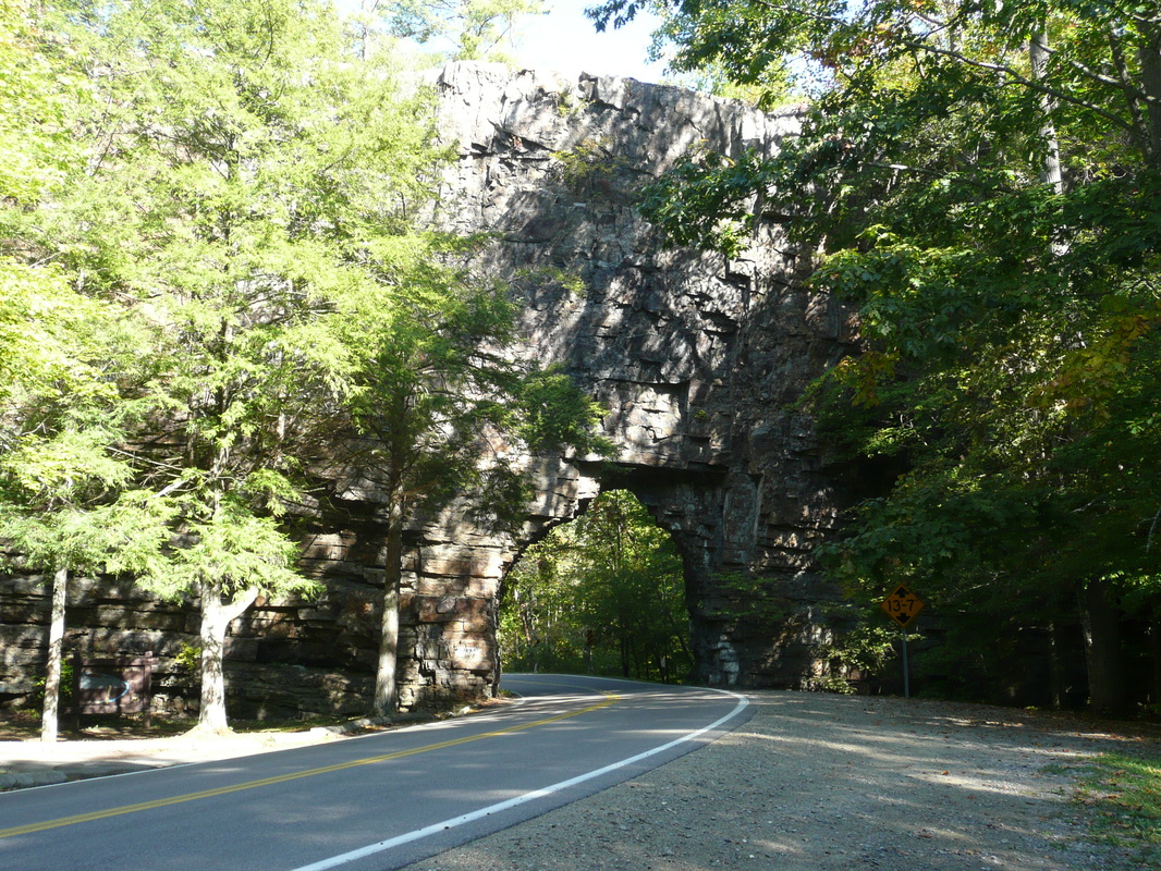
Backbone Rock
|
Backbone Rock Falls Trail
|
Distance: 0.8 miles round trip
The short hike to Backbone Rock Falls is among the prettiest in the region when the water levels are high. I do not recommend this hike during drier times when the falls are best described as a trickle. Like much of the Backbone Rock Rec Area, the trail was designed by the Civilian Conservation Corp and the craftsmanship that went into constructing the trail possessed a different philosophy than the design of many of the other trails in this region. The beauty of their work is impressive. From the trailhead, the path to Backbone Rock Falls is only 0.4 miles (0.8 miles round trip) but the brief stints of uphill and downhill can be steep and at times slick. There is one point at the top of the falls where a creek is crossed and this can be accomplished without getting wet. There are also many stone stairs to this particular hike, which have their advantages and disadvantages, dependent on the health of one's knees. Overall, this trail is easy to hike and easy to navigate with yellow blazes marking the way. This is a there and back again hike. Further Online Resources: Appalachian Treks Johnson County Trails Association Joyful Reflections Blog: Backbone Rock & Falls (Current as of Spring 2013) |
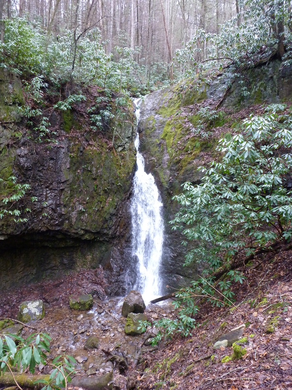
Backbone Rock Falls
|

|
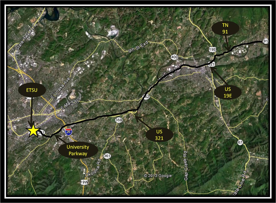
Driving Directions:
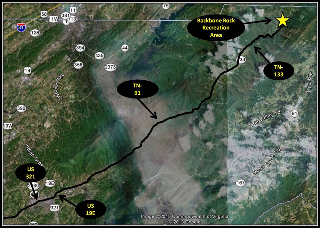
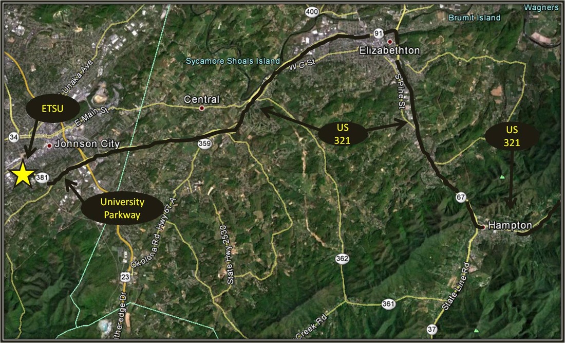
From ETSU, take a right onto University Parkway, also known as US-321. Follow 321 through Elizabethton, turning left onto US-19E. Almost immediately after turning left onto 19E, take the exit and turn right onto TN-91 headed toward Stony Creek.
Follow 91 for approximately 22 miles until reaching Shady Valley. In Shady Valley, continue straight onto TN-133 at a four-way stop. TN-91 veers right toward Mountain City, the wrong way for this hike. Follow TN-133 for about 9.5 miles. A parking area will be on the left. The hike to Backbone Rock Falls begins across the road from the parking area. You will know you've gone too far if you pass through a narrow tunnel forged through the nearby Backbone Rock. Driving directions using Google Maps is linked here. |
Gentry Creek Falls Trail
Distance: 4.6 miles round trip
Gentry Creek Falls is among the most beautiful falls in the region no matter the season or the weather. The draw of this hike is made more powerful with the knowledge Gentry Creek Falls Trail is truly unique compared to most the treks in Northeast Tennessee. Despite being deep within the verdant and mountainous splendor of the northeast border with North Carolina and Virginia, the 2.3 mile route to Gentry Creek Falls is mostly level with very few noticeable moments of going up. There is one exception and it comes toward the climax of the hike when the falls are visibly close. The last bit before reaching the base of the Falls is tough footing as the trail briefly ascends through rocky and uneven terrain. Setting aside the lack of huffing up hills, the trail closely follows Gentry Creek and there are approximately 13 points where the trail crosses Gentry Creek en route to the falls. This is a there and back again hike, so there are approximately 26 creek crossings. Rocks have been intentionally well-placed to make rock-hopping a possible option for many of the crossings, except when the waters are running high. Expect to get wet on this hike. At one time there were back-country log bridges across a few of the crossings. These bridges were built by a nearby private school, but they have at some point in the past been removed. Despite the many creek crossings, this trail is mostly easy to navigate with blue blazes marking the way. This is a there and back again hike. Note: I have not been to the falls that appear as the upper tier in photos of Gentry Creek Falls. There are warnings by many different accounts about the dangers involved in getting to the upper falls, but there is also guidance on how to get there for those interested. Further Online Resources: Cherokee National Forest Site TEHCC: Gentry Creek Falls Johnson County Trails Association (Current as of Spring 2014) |
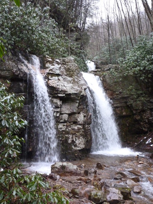
Gentry Creek Falls near Laurel Bloomery
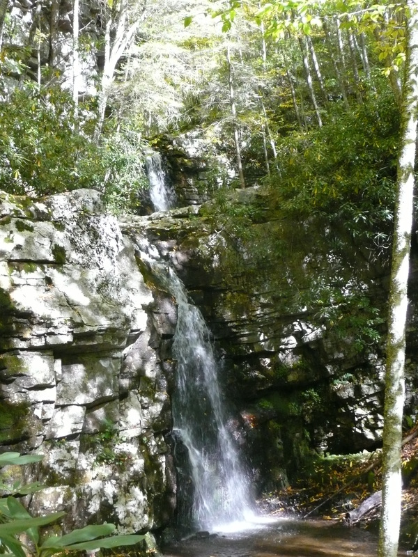
Gentry Creek Falls in Drier Times
|
|
Driving Directions:
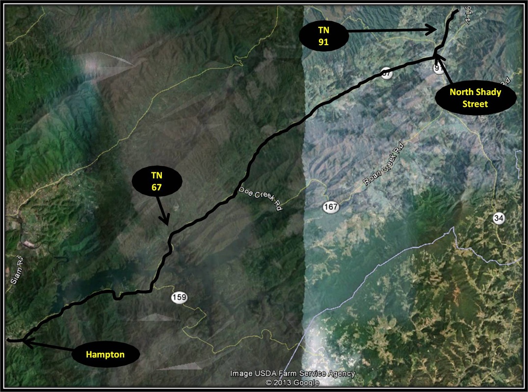
From ETSU, turn right onto University Parkway, also known as US-321. Stay on US-321 through Elizabethton heading east toward Hampton and Roan Mountain. Turn left onto TN-67 as it proceeds through Hampton and Butler on the way to Mountain City for approximately 18.5 miles.
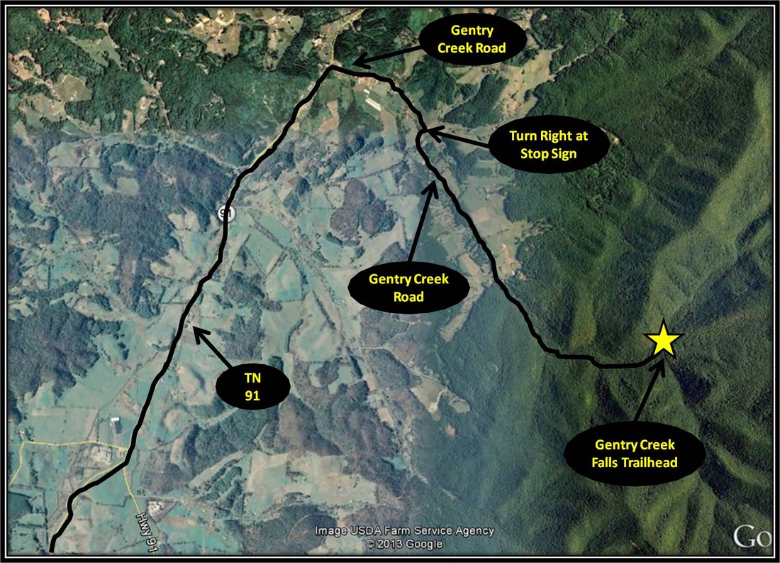
After reaching Mountain City, turn left onto North Shady Lane for 0.6 miles and then turn right onto TN-91. Follow TN-91 for approximately 6.5 miles before making a right onto Gentry Creek Road in the community of Laurel Bloomery. Follow Gentry Creek Road until coming to a stop sign. Turn right, staying on Gentry Creek Road as the road leads to Cherokee National Forest and becoming an unpaved forestry road. Follow the forestry road ignoring a left turn that leads to the parking area for Rogers Ridge Trail. Instead continue on past this parking area for about 1.1 miles where a parking area and trailhead for Gentry Creek Falls awaits. Be advised, the forestry road will not inspire confidence for those without 4wd, but it was manageable with a Honda Accord. Driving Directions to the start point for Gentry Creek Falls Trail using Google Maps is linked here. |
TN-91 to the Double Springs Shelter along the AT
Distance: 7 miles total, 3.5 miles one-way
The day-hike to Double Springs Shelter headed north along the AT from TN-91 begins with a crescendo by initially journeying through the pleasant, mountain pastures of Osborne Farm. Panoramas of the Shady Valley open up, as the AT ventures through the Arcadian landscape, often past cattle, before entering back into forest. From here on, the remaining trek to Double Springs Shelter is through woodland plentiful with wildflowers. Small False Hellebore, Basil Bee Balm, Self-Heal, Great Rhododendron, Carolina Lily and Starry Campion bloom during Summer. While Lady Slipper Orchid, Galax, Indian Cucumber Root & Spotted Wood Lily are among the many species found flowering on Cross Mountain during Spring. The hike to Double Springs Shelter from TN-91 is 3.5 miles. From the beginning of the hike, as the AT heads north through Osborne Farm for a half-mile the grade is very reasonable. In fact, the half-mile stretch through Osborne Farm's pastures is wheelchair accessible. A sign near the start of the hike goes into further detail on the particulars like trail width and ground consistency. A handicap parking spot is located near the start of the hike. Past the farm and through the forest, the AT is really quite reasonable staying on the ridge and along the hillsides. There are a few stretches of uphill on the way to the shelter that gets the heart pumping but nothing too steep. Two streams are crossed en route to the shelter, both can be done without getting wet. During drier times, the streams may not even be noticeable, but when the weather is wet, the trail can get mucky, esp. around the 2nd stream as the AT crosses through a depression that forms a bit of an upland bog. Past the stream crossings and after some uphill stints, the AT descends at a gradual rate to Double Springs Shelter, located on the left, as the AT makes a sharp right turn headed back uphill. The shelter is the turn around point for this hike, making for a seven mile hike in total. The AT through this section is well-manicured, as well as being well-marked by the White Blaze. Fence posts and rock piles have been marked with the White Blaze through the pastures. Just be aware in case you are inexperienced, cattle are present on Osborne Farm. Remember to close the gates behind you. Otherwise, the hike to Double Springs Shelter is an easy - moderate level hike. Further Online Resources: Johnson County Trails - AT: Cross Mountain to HWY 421 TEHCC: Double Springs Shelter Crossing Cross Mountain... by Johnny Molloy (JC Press) (Current as of Summer 2014) |

Osborne Farm along the AT near Shady Valley, TN
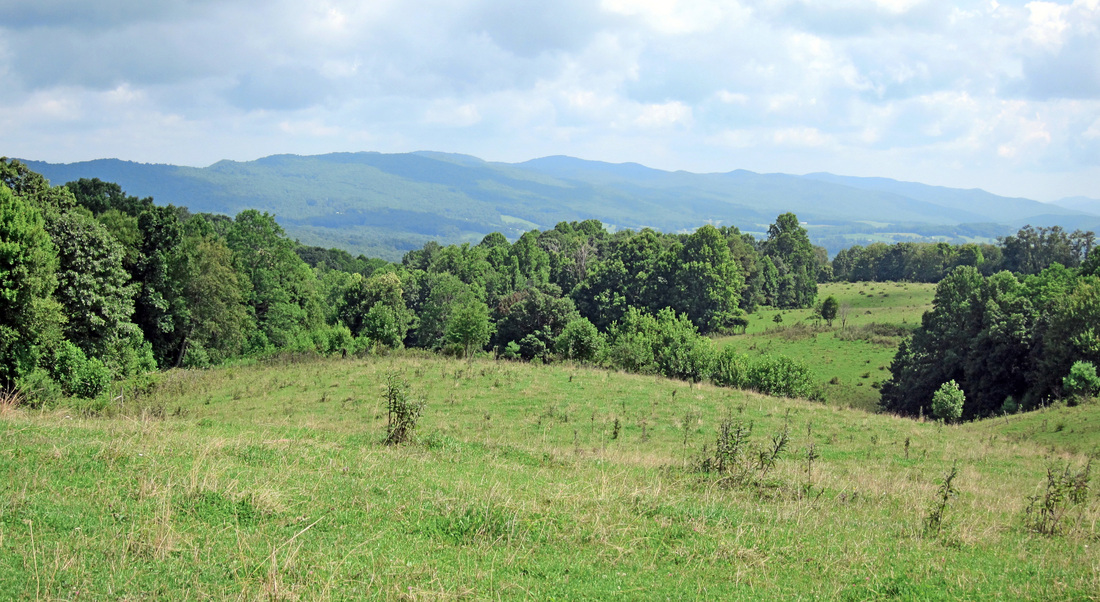
View of Shady Valley from Osborne Farm
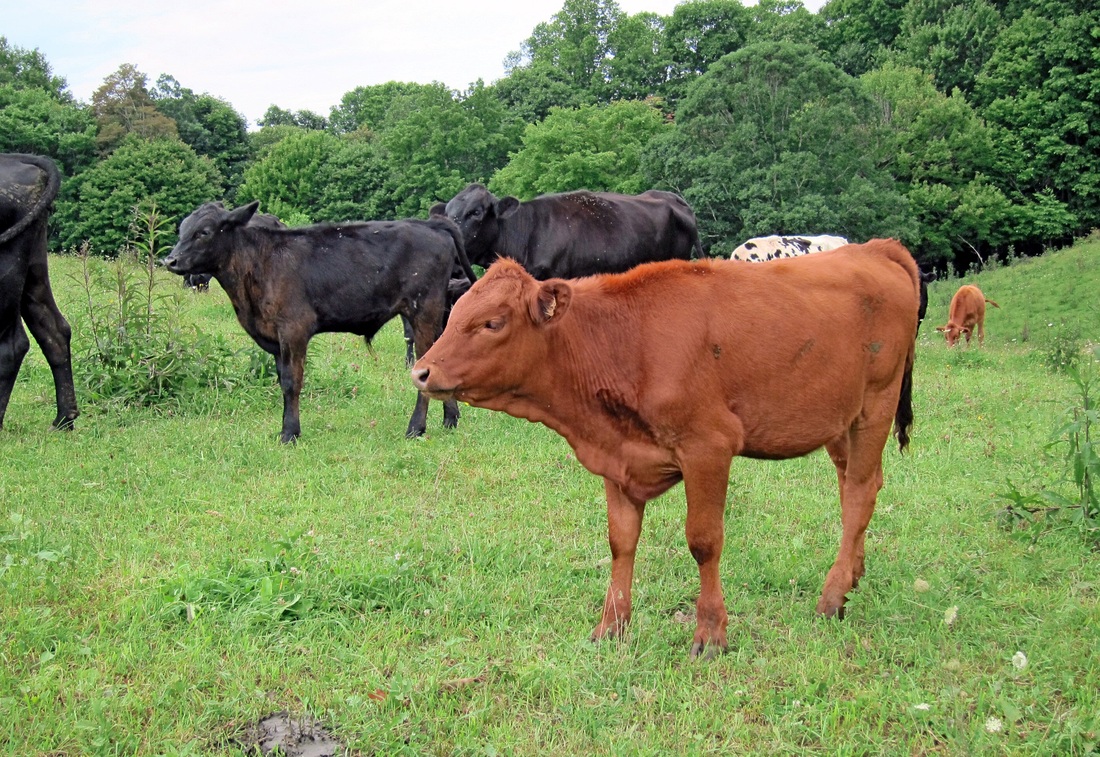
Cattle along the AT through Osborne Farm
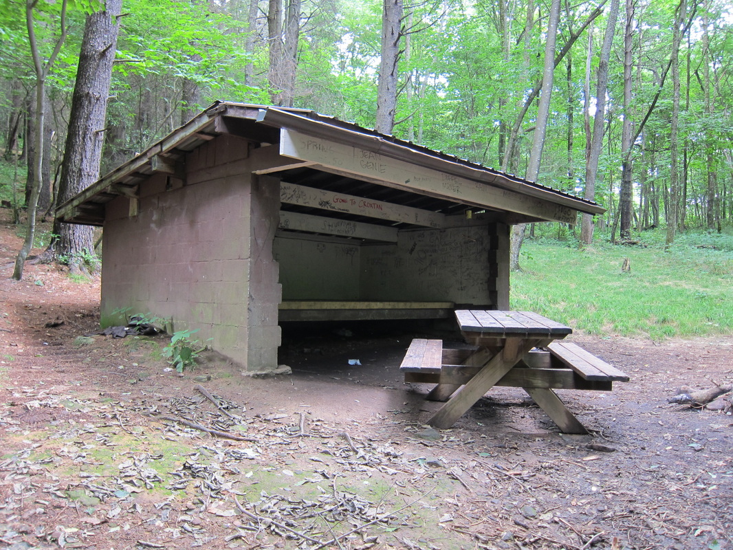
Double Springs Shelter sleeps Six not counting Field Mice
|


|
Driving Directions:
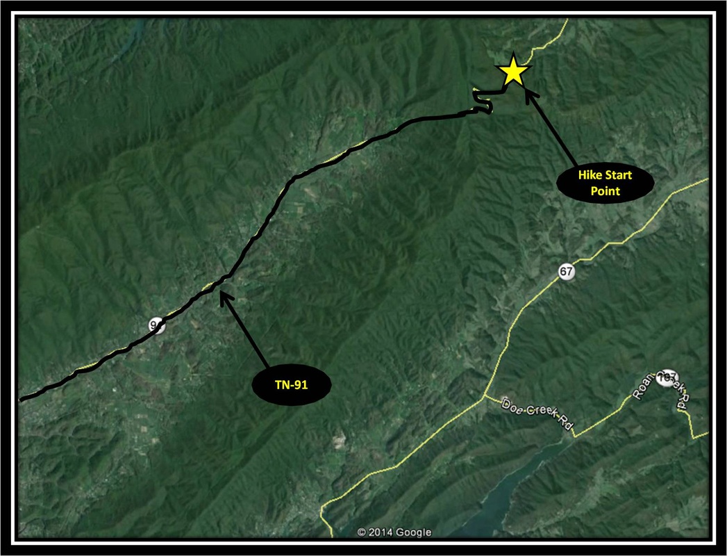
From ETSU, turn right onto University Parkway. Stay on University Parkway aka US-321 headed toward Elizabethton. Stay on US-321 through Elizabethton making a slight left on Broad St. Turn left onto US-19E headed toward Bluff City & very quickly after turning onto US-19E veer right exiting the highway onto TN-91 headed toward Stoney Creek & Shady Valley. Follow TN-91 for about 19 miles.
A moderately-sized parking area is on the right just as TN-91 passes by Cross Mountain Rd. There is also parking on the left side of TN-91. Signs mark where the AT intersects TN-91. Driving Directions to the Start Point using Google Maps is linked here. |
TN-91 to the Grindstaff Memorial along the AT
|
Distance: 6.6 miles total, 3.3 miles one-way
If Nick Grindstaff were alive today, what would he say about his hermitage, his once fortress of solitude becoming apart of the Appalachian Trail (AT)? What would he think of his resting place being a much-visited memorial to an intentional life suffered alone & what does a late 19th century 'no trespassing' sign look like? And yet the 3.3 mile (one-way) hike to Nick Grindstaff's Memorial along the AT makes for a great day-hike. In Spring, Trillium, Canada Mayflower, Mandrake, Spotted Wood Lily & other wildflowers bloom on the route to the memorial. During Summer, Great Rhododendron, Turk's Cap Lily, Spotted Wintergreen, Purple Bergamot, White Bergamot, & other wildflowers also bloom along the way to the Grindstaff Memorial. The hike can also provide welcome relief from the summer heat by being high on a ridge and under a forest's shade. Starting from the intersection of TN-91 & Cross Mountain Rd, head south along the AT into the tree line. The AT throughout this hike stays under the cover of forest generally following Iron Mountain's spine headed toward Wilbur Dam, though this particular day-hike's turn-around point is well before then. Not far past the start point, the AT intersects with a forestry road. A left turn onto the forestry road will lead to the nearby Cross Mountain Rd. Continue straight through the intersection following the AT. Like always the White Blaze marks the well-worn & welcoming foot path. After passing the forest road, the AT descends and crosses through a couple of bogs. Foot bridges have been built across the bogs to protect shoes from getting muddy or possibly lost & most importantly the wetlands. In between the bridges, a short, blue-blazed side-trail on the left leads to a water source. Past the bogs, the AT ascends, sometimes steeply, occasionally descending, following the rocky ridge toward the memorial. Doris Gove in her great work Exploring the Appalachian Trail: Hikes in the Southern Appalachians expertly explains the geological history of the Southern Appalachians in her description of this particular part of the AT. I recommend reading if you get the opportunity. In her work she describes Iron Mountain's protruding rocky spine as being hundreds of millions of years ancient, tossed above younger geological layers during incredible continental upheaval predating the super-continent Pangea. Highly resistant to erosion, the rocks sticking out along the ridge were forged under the most incredible heat & friction. Shortly before the Grindstaff Memorial is reached, a blue-blazed side-trail cuts to the right leading to another water source. Just a little past this side-trail, another very short side-trail veers right, this time to the Grindstaff Memorial, which is close to & visible from the AT. As a there and back again hike, the way back is the way you came making for a hike of 6.6 miles total in distance. The route is well-marked with the White Blaze and the path is well-worn into the ground making navigation easy. The trail can get muddy after rain but there are no stream crossings or wetlands crossings to be concerned with, in part do to foot bridges. This hike is easy to moderate difficulty level do to the distance along with a few steep uphill moments. Further Online Resources: Hiking Bill: Nick Grindstaff Memorial Appalachian Treks: Uncle Nick Grindstaff Johnson County Trails Association: Appalachian Trail (Current as of Summer 2014) |
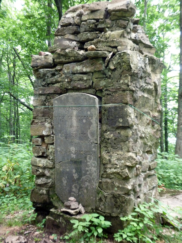
Memorial to the Hermit Nick Grindstaff
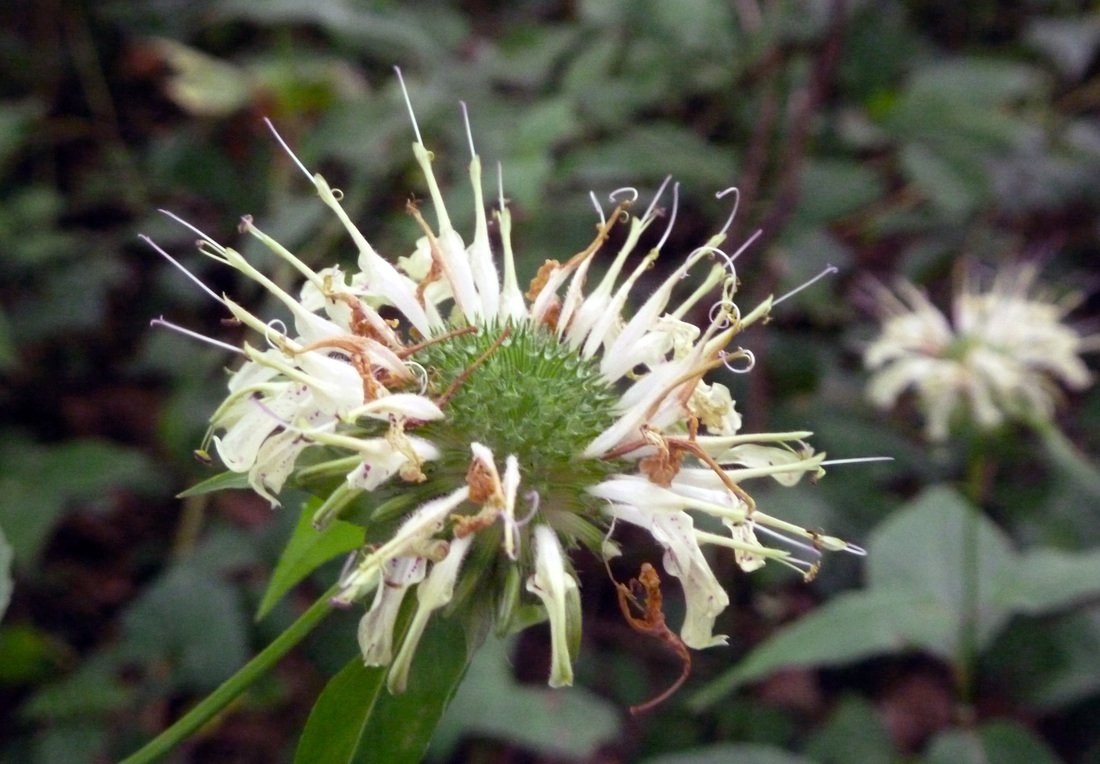
Basil Bee Balm
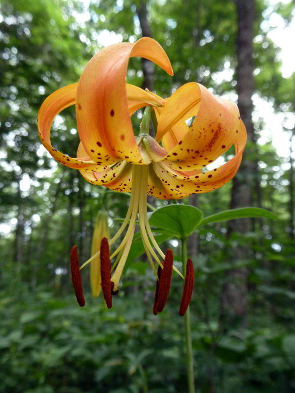
Turk's Cap Lily(?)
|
|
Driving Directions:
From ETSU, turn right onto University Parkway. Stay on University Parkway aka US-321 headed toward Elizabethton. Stay on US-321 through Elizabethton making a slight left on Broad St. Turn left onto US-19E headed toward Bluff City & very quickly after turning onto US-19E veer right exiting the highway onto TN-91 headed toward Stoney Creek & Shady Valley. Follow TN-91 for about 19 miles.
A moderately-sized parking area is on the right just as TN-91 passes by Cross Mountain Rd. There is also parking on the left side of TN-91. Signs mark where the AT intersects TN-91. Driving Directions to the Start Point using Google Maps is linked here. |
