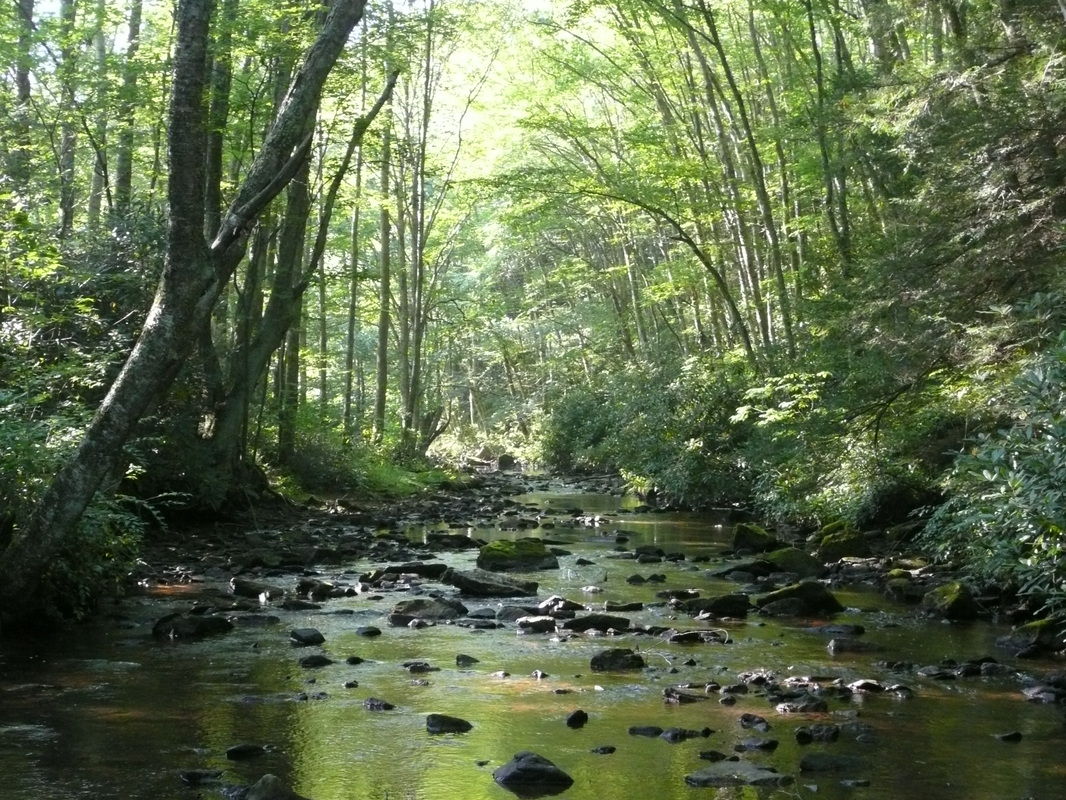
Dennis Cove
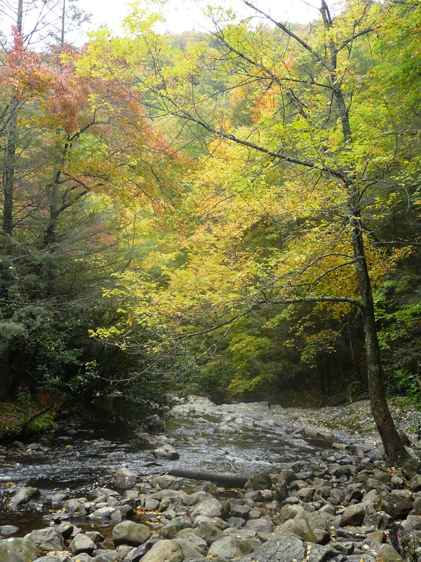
Along Laurel Fork Trail
Dennis Cove is well known because it is the start point for one of the most popular hikes in the region, the hike to Laurel Falls. Besides the hike to Laurel Falls, Pond Mountain and Dennis Cove offer a variety of outdoor activities. There are many more miles of trails to be hiked, many that lead to other beautiful waterfalls. Dennis Cove Recreation Area has a campground with 12 sites, but there are also many other great back-country spots to camp at as well. Below the campground, Laurel Fork Creek is stocked with rainbow trout. Further information on Dennis Cove can be found at the Cherokee National Forest Website.
The trails described below are: the AT to Laurel Fork Falls, the AT to Coon Den Falls, Laurel Fork Trail, & the AT to Watuaga Dam from Shook Branch Recreation Area.
The trails described below are: the AT to Laurel Fork Falls, the AT to Coon Den Falls, Laurel Fork Trail, & the AT to Watuaga Dam from Shook Branch Recreation Area.
|
Driving Directions:
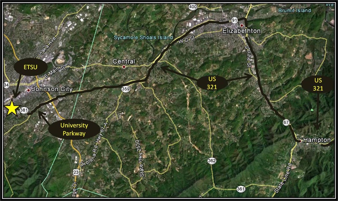
To get to the trailhead from ETSU, from West Lake Street take a left onto Southwest Avenue, and merge right onto University Parkway also known as U.S. Highway 321.
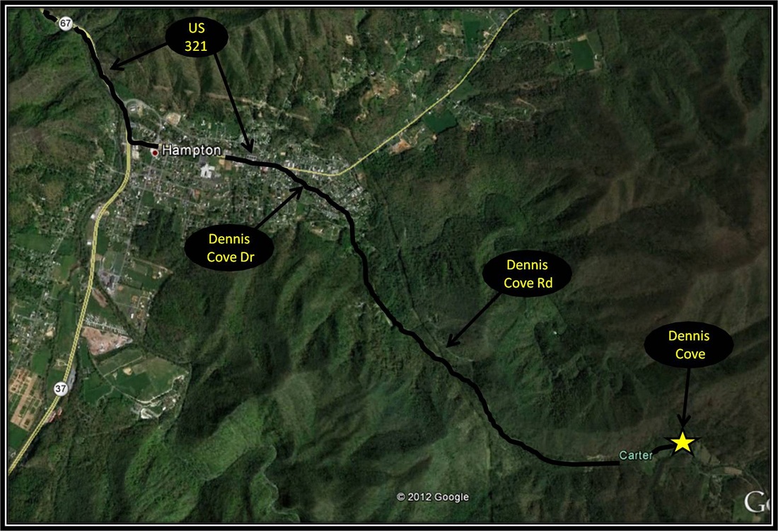
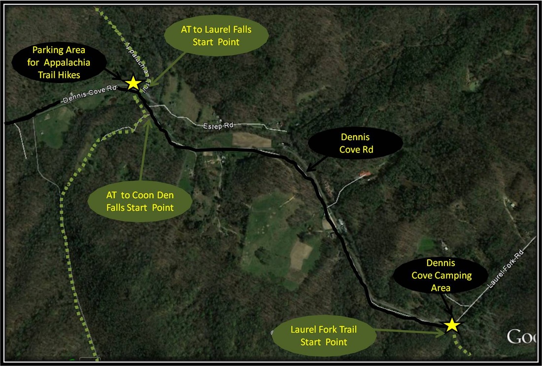
Continue on 321 to Elizabethton. Stay on 321 while traveling through Elizabethton. Turn right in the direction of Hampton at the intersection where 321 merges with U.S. Highway 19. Continue on 321 south to Hampton. Turn left as U.S. 321 diverges from U.S. 19 in Hampton near Pizza Plus and Subway. Continue on 321 through Hampton for just 0.8 more miles before making a right on Dennis Cove Road. Follow the curvy and at times steep Dennis Cove Road over the mountain for about 3.8 miles before reaching the parking areas on the left, or right for the Appalachian Trail. Directions to Dennis Cove using Google Maps is linked here. |
Appalachian Trail to Laurel Falls
Distance: 2.6 miles round trip
From Dennis Cove headed north, the hike to Laurel Falls along the Appalachian Trail begins with the roar of Laurel Fork Creek as the dense growth of hemlock trees and rhododendrons offer shade and occasional glimpses of choice camping spots. The forest opens up to let more sun through as the trail crosses the creek by way of a footbridge. The trail then winds around the mountainside before descending down a long rocky staircase into a gorge and to the base of the grand Laurel Falls. The trek to and from Laurel Falls by way of Dennis Cove is 2.6 miles. This is a very popular hike and the path is easily followed but there are a few things to consider. The rocky staircase that leads to Laurel Falls is marked but the path can be hard to spot because at first the staircase looks very similar to the rest of the rocky mountainside. Also the rocky staircase is long, uneven, and steep. The way down can be hard on the knees and the way up can be ruthless on the lungs. Remember to take a right once complete on climbing back up from the falls because there is more than one way to the falls. Taking a left will lead away from Dennis Cove. You will know that you have gone the wrong way if you come across the Laurel Fork Shelter. A link to an article on this hike that I previously published with the East Tennessean can be found here. Further information on the hike can be found here. (Current as of Autumn 2013) |
Near Laurel Falls
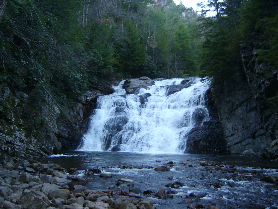
Laurel Falls
|
Appalachian Trail to Coon Den Falls
|
Distance: Varies, but approximately 5 miles round trip for the trek described below.
The quickest way to get to Coon Den Falls is by following the moderately steep Coon Den Falls Trail for approximately half a mile. The trail-head for this hike is located a little further down Dennis Cove Road from the Appalachian Trail (AT) parking area and before the parking for the Laurel Fork Trail starting point. This hike is approximately 1.1 miles round trip in length and is a pretty straightforward hike. Just keep in mind the hike is steep and can be a bit slick. Coon Den Falls Trails continues on past the falls eventually linking up with the Appalachian Trail about 0.8 miles from Coon Den Falls. I like to extend the distance of this hike by taking the Appalachian Trail from Dennis Cove to Coon Den Falls. In addition to more time to stretch out the ole legs, this route also offers a couple of nice overlooks from rock outcroppings along the way by way of the AT. From Dennis Cove, the route to Coon Den Falls following the AT is approximately 2.5 miles in distance or five miles round trip as a there and back again hike. Starting from the Parking Area, the trail is mostly uphill. At first the path is open as the trail journeys through traces of pasture but soon the trail cuts back into the deep forest. Much of the hike is through dense forest but there are a couple of rock outcroppings along the AT that have some nice views of the nearby mountains. Coon Den Falls Trail connects with the AT not long after the trail starts heading downhill approximately 1.7 miles from the start point. Make a left onto Coon Den Falls Trail and follow the trail as it goes downhill for about 0.8 miles to reach Coon Den Falls. Coon Den Falls is a beautiful waterfall which is powerfully influenced by the season and by the amount of recent rains so spring is often the best time for seeing Coon Den Falls at her mightiest. From the falls, you can either head back by way of the AT or by continuing to head down Coon Den Falls Trail for 0.5 miles. Upon reaching Dennis Cove Road, just make a left and follow the road for a little over a half mile to get back to the AT parking. Coon Den Falls Trail is marked with a blue blazes along the trail and the AT is marked with white blazes. Information on the hike can be found online here. (Current as of Fall 2012) |
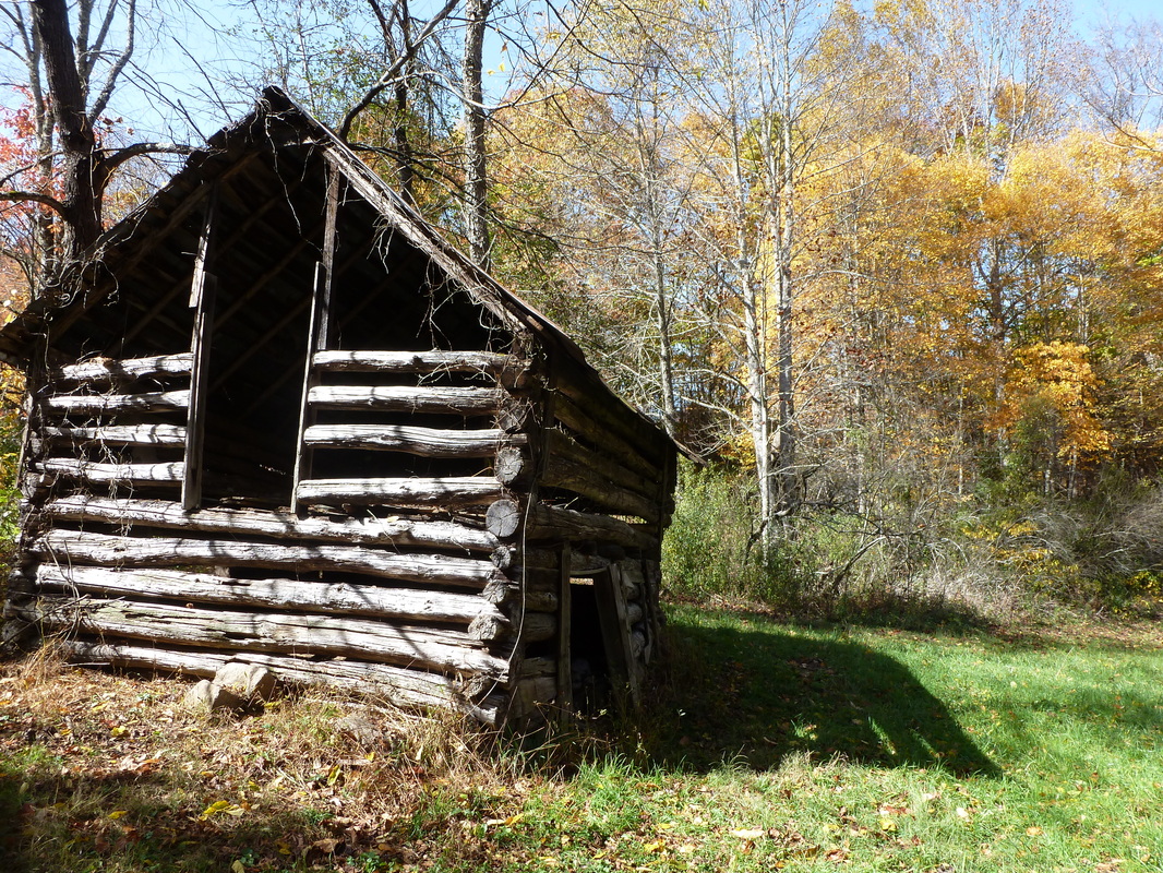
Barn on the AT not far from the Dennis Cove Parking Area
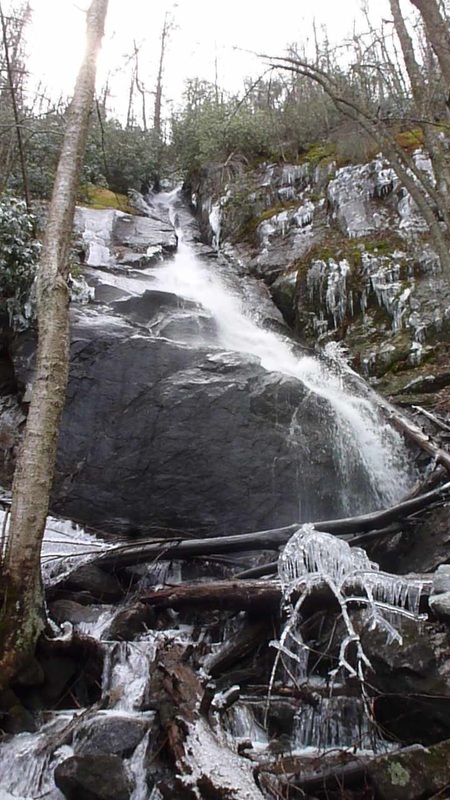
Coon Den Falls
|
Laurel Fork Trail
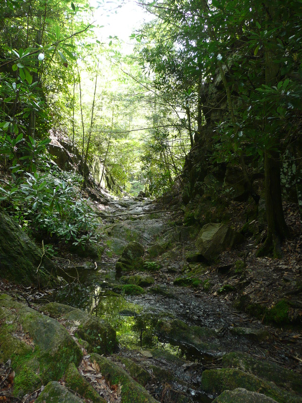
Laurel Fork Trail
More to Follow
Trail highlights include Dennis Cove Falls.
Most of the creek-crossings on hikes here regionally are fairly risk-free and often accomplished without saturating shoes and socks through rock-hopping. The Laurel Fork Trail is a different beast altogether with a few, above knee-deep creek-crossings, sometimes through fast water. While an awesome trail, not recommended after strong rains or for anyone who truly detests creek-crossings.
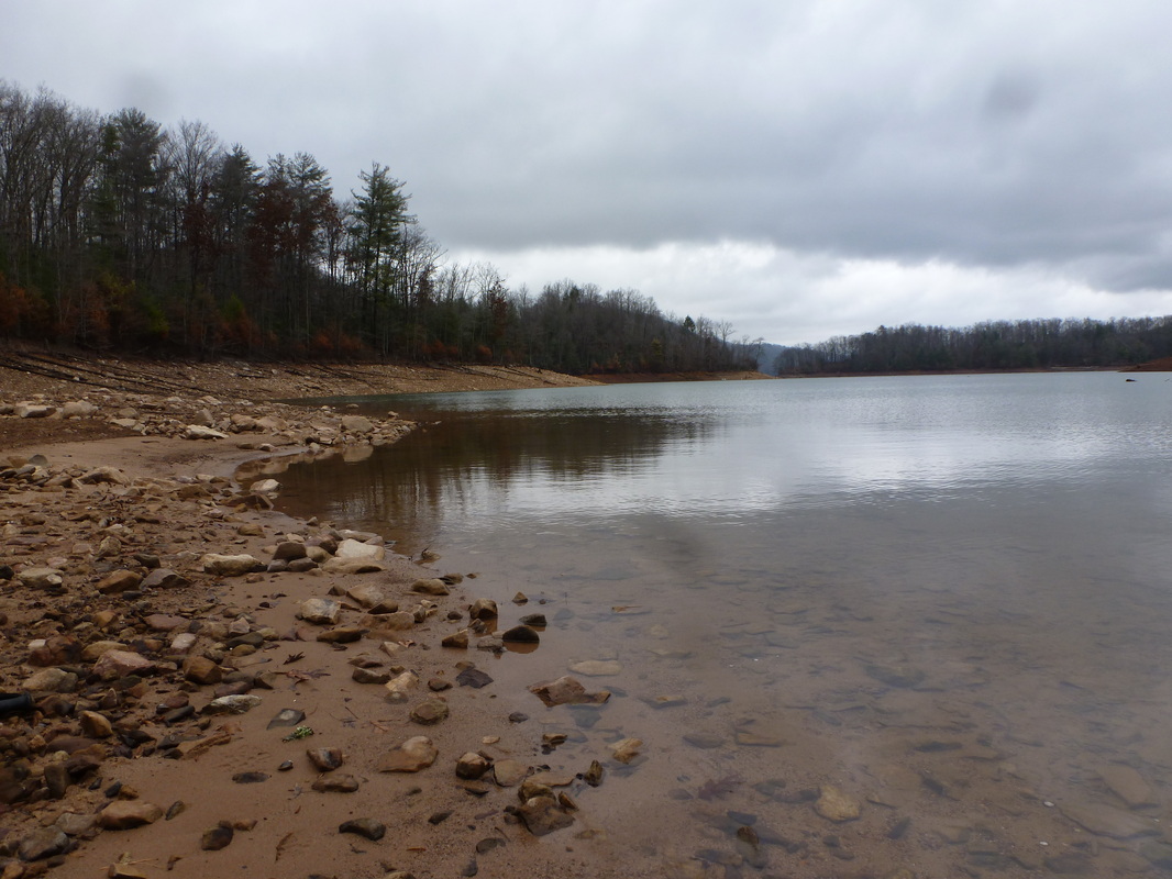
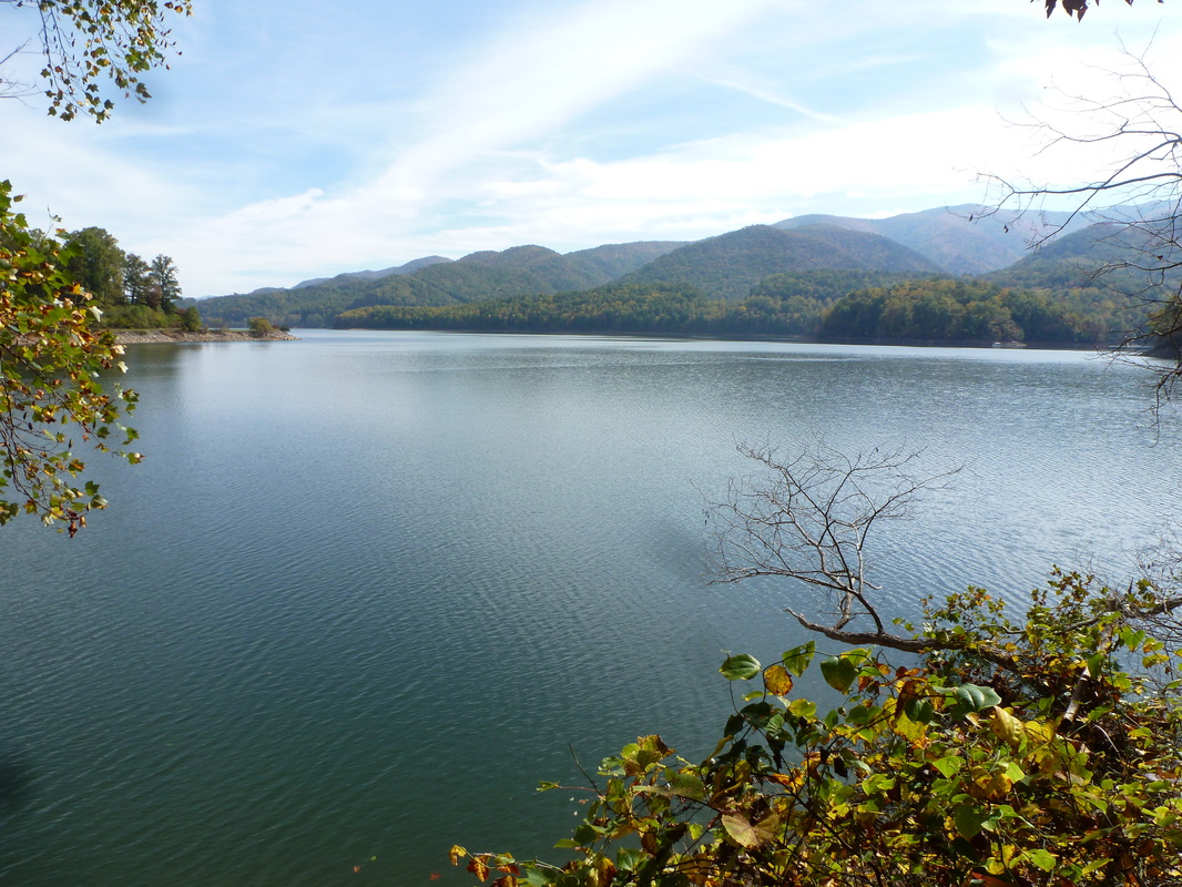
Appalachian trail to Watuaga Dam from Shook Branch
|
Distance: 4 miles round trip
The Appalachian Trail offers many beautiful vantages along Watuaga Lake as the path follows the lake's southern shore from Shook Branch Recreation Area to Watuaga Dam. The journey to Watuaga Dam from Shook Branch is only two miles one way or four miles round trip as this is a there and back again hike. Starting from Shook Branch, most of the hike is fairly level paralleling the lake from within the forest line. However, the AT through this section also has moments of both uphill and downhill on the way to Watuaga Dam. The uphill moments are reasonable both in their steepness and in their length. Though there is some uphill prior to, the bulk of the uphill & downhill is experienced just after passing the Watuaga Lake Shelter. The shelter is one mile from both Shook Branch and Watuaga Dam, the midway point between the two. The shelter itself is located on a side trail to the left, not far from the AT. There are minimal stream crossings along the way & all of them can be accomplished by rock-hopping. The trail is well maintained and well-marked by the white blaze. There are moments when the forest floor can loose the trail but in those moments the blazes keep navigation simple. Shortly before Watuaga Dam is reached, the trail merges onto an asphalt road. After reaching the dam, the journey back to the start point is two miles. At four (4) miles round trip, this hike is ranked at an easy-to-moderate difficulty level do to distance and some uphill. The dam was built in the 1940s by the TVA as a part of President Franklyn Roosevelt's New Deal. Construction of Watuaga Dam began in 1942, was postponed do to the War and completed in 1948. Like a lot of of Cherokee National Forest's forest, Watuaga Lake's timelessness is actually less than a century old. Further Online Resources: Hiking Bill Ranger Annette Cherokee National Forest: Shook Branch Beach (Current as of Autumn 2013) |
View of Watuaga Lake from along the AT
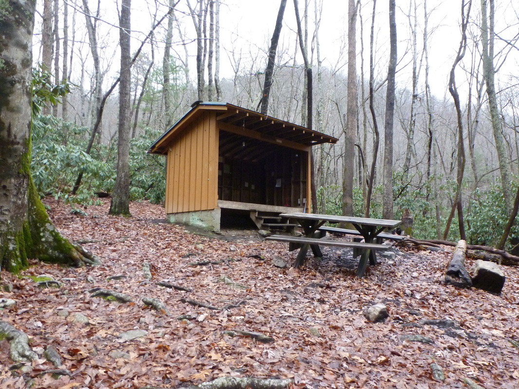
Watuaga Lake Shelter
View of Watuaga Lake from AT
|
|
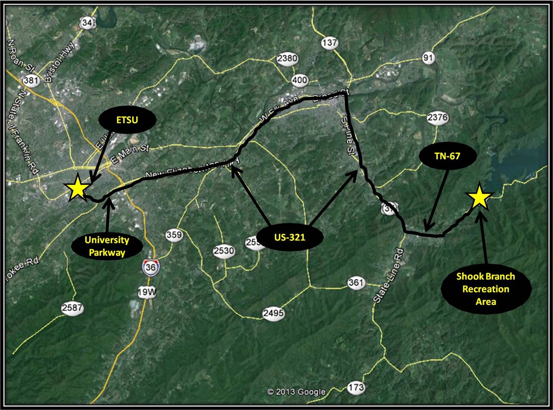
Driving directions:
From ETSU turn right onto University Parkway. University Parkway is also known as US-321. Stay on US-321 as it continues through the city of Elizabethton and heads toward Hampton. In Hampton, turn left onto TN-67, also US-321. After turning left onto TN-67, follow the highway for about 3 miles and Shook Branch Recreation Area will be on the left.
Shook Branch Recreation Area requires a $2 fee for parking/day-use. This fee can be avoided by parking at a pull-off area located Just before reaching the left turn into Shook Branch. The pull-off is on the left of TN-67, just a little past Oliver Hollow Rd. Shook Branch has a beach swimming area and picnic tables. Driving Directions using Google Maps is linked here. |
