Cummins Falls State Park

Cummins Falls
Cummins Falls
|
Impressions:
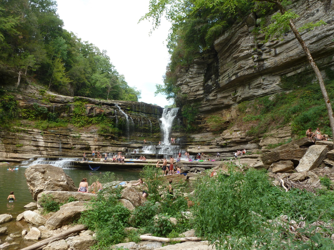
Located on the Blackburn Fork State Scenic River, Cummins Falls is the 8th largest waterfall in Tennessee. The river falls 75ft before crashing into a crescendo of stepped swimming holes. I think when the weather is good the Park stays peopled, so if you are not a fan of crowds, I recommend visiting on days when the weather is less than summer or in the early morning. As you drive into the large parking area you will notice a gravel road to the right headed down the hill. Hike down this Gravel Road eventually passing a couple of porta-potties to the left. Not long after passing the porta-potties a dirt trail veers off to the left. This path leads down to the Cummins Falls Overlook. The trail travels past the overlook through dense forest, largely paralleling the cliff side. Eventually the trail steeply descends down to the river. Upon reaching the river turn left and follow the river until reaching the Falls. There is at least two points where the river is crossed. The way back is ruthlessly steep esp. as you start back up the hill. Besides the steep walk back to the parking area, be aware the terrain along the river can be rocky and slick (Summer 2012). Note: This information is sure to become old. Cummins Falls was the newest State Park when I visited and I am confident changes have already occurred such as refinements to the trail and to the parking area. Further Online Resources: Official Cummins Falls State Park Site Link to Park Brochure PDF Tennessean Article on Cummins Falls |
Driving Directions:
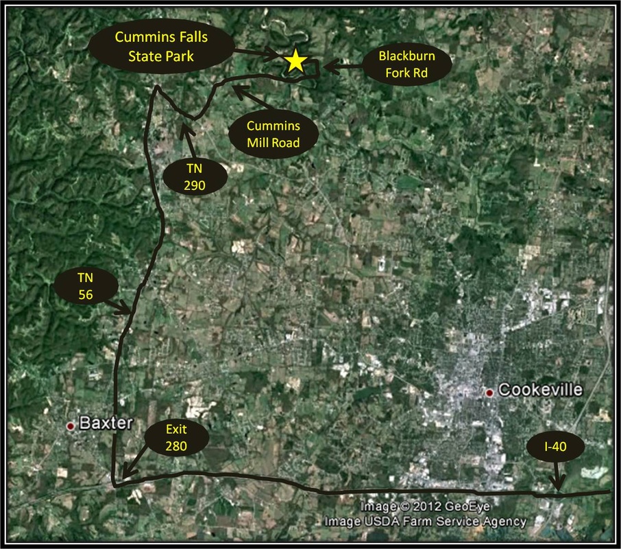
Cummins Falls State Park is located appoximately 221 miles from ETSU & Johnson City, Tn. Driving directions to Cummins Falls using Google Maps is linked here.
Cummins Falls State Park is located appoximately 221 miles from ETSU & Johnson City, Tn. Driving directions to Cummins Falls using Google Maps is linked here.
