 First isn't always Best
The First Frontier at a Glance
In the Age of Legends... more to follow
In the Age of Legends... more to follow
The Cherokee
|
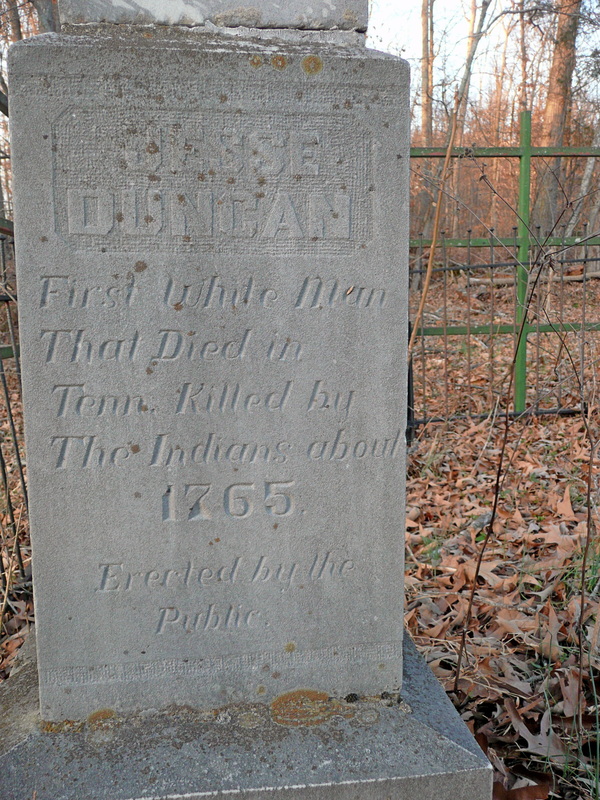
1400s(?): The first Europeans to explore the Southern Appalachians were Spanish conquistadors led by Hernando De Soto in 1540. Another conquistador, Juan Pardo led an expedition exploring the region in 1566, like De Soto, in search of his own Inca or Aztec Empire to conquer.
Both expeditions made contact with the dominant civilization of the Southern Appalachians and fortunately for the Cherokee they were a society lacking in gold. Despite not finding precious metals, the Spanish, unbeknown to them, unleashed their most effective weapon against the native populations, their germs. The Cherokee and many other tribes on both American continents suffered horrible death rates from diseases spread unknowingly by the conquistadors. How long the Cherokee had existed in the Southern Appalachians prior to the Spanish expeditions is a bit of a mystery, with some speculating the Cherokee first came to the region in the 1400s. Others argue for a likely much earlier date. There is some consensus on the Cherokee originating from territory controlled by either the Iroquois Confederacy or the Delawares. They may have been forced south by the Delawares, having been defeated militarily. Perhaps a resource depletion of some kind forced the large group south. The Cherokee language is a part of the Iroquoian language family. Many of the other southeastern tribes like the Creek and Choctaw speak related languages collectively known as Muskogee, unrelated to the Cherokee language. The name Cherokee derived from the Creek name for the Cherokee which translates as "Other-Speaking Peoples." The Cherokee call themselves, Aniyunwiya. By the 1700s, the Cherokee claimed territory from modern day South Carolina, Western North Carolina, West Virginia, Kentucky, Tennessee, Northern Alabama, and Northern Georgia. Most the territory was used for hunting and foraging. The best hunting grounds were often contested by neighboring tribes, esp. Kentucky's rich, alluvium plains, a paradise for the large herds of hungry bison, deer, and elk. The Cherokee's permanent settlements were located on the southern portion of their territory, divided into three distinct regions. The Lower Towns were located in Western South Carolina into Georgia. The Middle Towns were located in Western North Carolina and Northern Georgia, while the Overhill Towns were located in East Tennessee. By the end of the 1700s, the Lower Towns had settled towns further west, with the encroachment of the Colonists. Their society was agricultural, with corn being the Cherokee's primary staple crop. Unlike nomadic peoples, they lived in cabins made of logs and earth. Like many of the other North American Tribes, the Cherokee were not a hierarchical society. They were more like the Greek City States than the Romans, in that the Cherokee towns were united by a common culture and language and not by one ruling voice. Additionally, the Cherokee were united by being a member of one of seven clans, usually determined through birth; as both parents were most likely to be from the same clan. The seven clans are: Long Hair, Blue, Wolf, Wild Potato, Deer, Bird, and Paint. Each clan had their own peculiar strength that philosophically and religiously provided balance to Cherokee society. For instance, the Longhair Clan were known for being peaceful and during times of peace, often a member of their clan would be chosen to be a decision-maker, where as the Wolf Clan were known as being protectors and during times of war, a member of their clan was chosen to lead. Northeast Tennessee, like most of the territory claimed by the Cherokee was primarily used as a hunting ground. For a time, the Cherokee shared the area described by this site with other tribes like the Shawnee, but by the time the British entered the story, the Cherokee were the dominant people of the region. In particular, Northeast Tennessee was located close to the Cherokee's Overhill Towns. Further Links: Tennessee Encyclopedia: Overhill Cherokees by Gerald Schroedl Cherokee.org: Cherokee Clans Cherokee Journey: Pre-European Territorial Claims PBS.org: Indian Country Diaries: Oral History of the Cherokee NPS.gov: Cherokee - Great Smoky Mountains National Park |
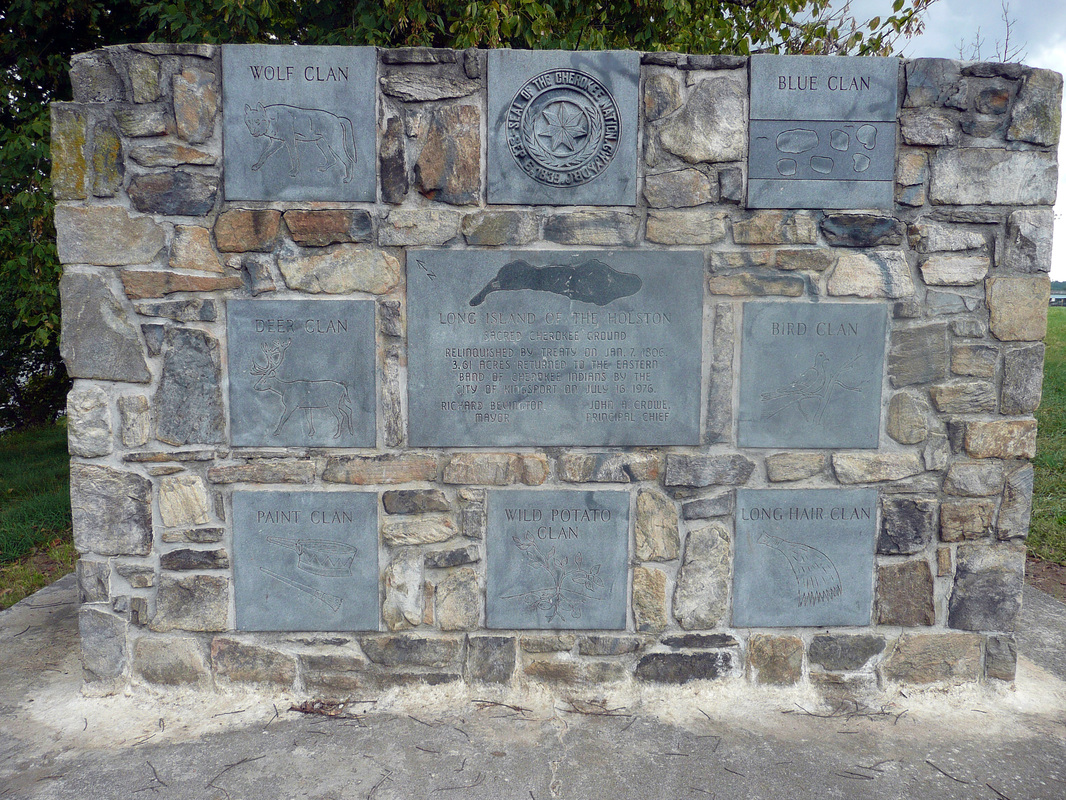
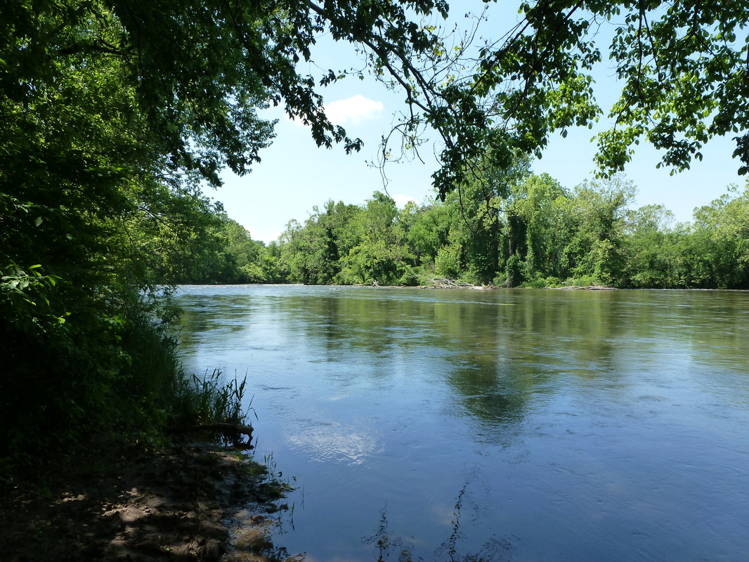
Cherokee Memorial on the Long Island
|
The Cumberland Gap
13 April 1750: The Loyal Land Company contracted Thomas Walker to lead an expedition west of the Allegheny Mountains to survey about 800,000 acres for purchase on the approval of the Virginia legislature. Thomas Walker traveled through Southwest Virginia, eventually following the Warrior Trace to a pass in the mountains on 13 April 1750. Walker would name the gap for the Duke of Cumberland.
Walker was most likely not the first English descendant to venture through Cumberland Gap. Almost a century earlier in 1673, James Needham and his indentured servant Gabriel Arthur traveled to what is today upper East Tennessee to form a trading relationship with the Cherokee. During the expedition, Needham briefly returned east and on his return trip was killed, possibly by a tribe hoping to remain a middle-man between the Cherokee and the English in the trade of deerskin. Needham had left his indentured servant Gabriel Arthur with the Cherokee and Arthur remained with the Cherokee after Needham's death for a year, traveling with them, including through the Cumberland Gap. In 1769, Daniel Boone followed the Warrior Trace through the Cumberland Gap. He was exploring the region for Richard Henderson, owner of the Transylvania Company, who was seeking to settle a 14th colony west of British and colonial claims. At the Sycamore Shoals in March 1775, Henderson negotiated with the Cherokee, purchasing much of what is today Kentucky and Middle Tennessee. He also negotiated for a passageway to the territory. The passageway was through the Cumberland Gap. Daniel Boone then led a crew in constructing Wilderness Road from the Long Island of the Holston through the Cumberland Gap. The road was completed at the end of April 1775. The colony of Virginia would void most of Richard Henderson's purchase, confiscating most of the land he negotiated for. The Cumberland Gap remained a major passage to the west for over a century. Further Links: Virginia.edu: Thomas Walker and the Cumberland Gap Virginia.edu: Thomas Walker's Journal Envisioning the West: Doctor Thomas Walker's Journal 1750 Tennessee Encyclopedia: Daniel Boone by Michael Toomey Tennessee Encyclopedia: Early Exploration by Michael Toomey |
Through the Cumberland Gap

Quote by Frederick Jackson Turner at Cumberland Gap National Historic Park
|
Daniel Boone
Late 1750s: Western Expansion
The earliest colonists to enter the region described by this site in Northeast Tennessee were known as Longhunters. Longhunters went on extended hunting trips, traveling in small groups, away from colonial controlled territory west of the Appalachians. They lived off the land for months, sometimes longer, collecting furs, a valuable commodity that paid very well. The legendary longhunter Daniel Boone began his exploration of this region not long after getting married and moving to Rowan County, NC near the Yadkin River in the mid-1750s. A historical marker in Boones Creek notates where a tree once stood, scarred by Daniel Boone's on hand, marking where he had killed a bear in 1760. Boone also camped in the caves near Buffalo Creek located on the modern-day property of the Tipton-Haynes Historic Site. He hid under falls along Boones Creek, not far from where local residents pay their cable bill. He was avoiding detection from unfriendly natives, most likely Cherokee. In the mid-1760s, Boone formed a business relationship with Richard Henderson, a land speculator looking to settle a 14th colony. From 1769 - 1771, he led a small expedition exploring territory west of the Cumberland Gap in modern-day Kentucky and Middle Tennessee. As Richard Henderson negotiated the Transylvania Purchase in 1775, he employed Daniel Boone to lead a crew of roughly 30 men to build Wilderness Road from the Long Island of Holston to Otter Creek, through the Cumberland Gap. Not long after completing the road, Boone founded Ft Boonesborough in what is today Kentucky. Further Links: Fort Boonesborough Living History: Daniel Boone Tennessee Encyclopedia: Daniel Boone by Michael Toomey Tennessee Encyclopedia: Early Exploration by Michael Toomey Mtnlaurel.com: The Border Series - The Long Hunters by Mary B. Begley |
Folklore has it that Daniel Boone hid under these falls from possible danger
|
The Wataugans & the Early Settlers
|
1760s: The initial settlement of Northeast Tennessee began near the Holston, Watauga, and Nolichucky Rivers. William Bean is reported to be the first permanent settler to the area. Having explored the region previously with his friend Daniel Boone, Bean built a cabin near Boone's Creek in 1769. A monument commemorating his achievements rests on the site of where his cabin once stood, now on TVA land, near Sonny's Marina.
The Carter's Valley area was likely settled before William Bean had set up permanent residence. Settlement originating from Virginia had started around 1765, not long after militia built Fort Robinson on the Long Island of Holston while en route to Fort Loudon. James Robertson, who also played a vital role in settling Middle Tennessee, was among the founders of the Watauga Settlement in the late 1760s. Jacob Brown set up residence on the Nolichucky River, not far from where TN-107 turns right toward Tusculum, as TN-81 continues to Erwin. The encroachment infuriated many Cherokee, esp after it was determined the settlements were south of the Virginia border and within Cherokee territory. The settlements on the Holston were given some reprieve, but the Cherokee expected the withdrawal of settlement along the Watauga and Nolichucky Rivers. The Cherokee's sentiment was in line with British Law prohibiting settlement beyond the Proclamation Line of 1763. The Wataugans refused to leave and were eventually able to come to terms with the Cherokee in 1775 as Richard Henderson negotiated the Transylvania Purchase. Jacob Brown, a gunsmith and metal smith, possessed the kind of skills popular among the Cherokee and he was able to also secure his settlement along the Nolichucky. During celebrations, a Cherokee Chief was killed in cold blood. Despite apologies from Wataugan leaders, strained relations became more so. As war broke out between the colonists and the British, the Cherokee sided with the British having already tasted the ambition of the new Americans. So in 1776, the Cherokee led a series of attacks on the frontier, within their own territory. Further Links: Tennessee Encyclopedia: Sullivan Counties by Blythe Semmer Watauga Association of Genealogists: History Alive! Tennessee Encyclopedia: Watauga Association by W. Calvin Dickinson |
|
Transylvania Purchase
|
14 March 1775: Western Expansion
Richard Henderson, owner of the Transylvania Company, negotiated the purchase of 20 million acres in modern day Kentucky and Middle Tennessee from the Cherokee at the Watauga Settlement. The Transylvania Purchase is also known as the Treaty of Sycamore Shoals. By 1777, Virginia had nullified most of the treaty, confiscating the land that would become Kentucky. Henderson was compensated with significantly less acreage. He also maintained ownership of the land in Middle Tennessee. Richard Henderson employed Daniel Boone to construct Wilderness Road from the Long Island through the Cumberland Gap, which was completed by the end of April 1775. The Transylvania Company also contracted James Robertson and John Donelson to lead expeditions, one by land and the other by multiple rivers to Middle Tennessee. Further Links: Tennessee Encyclopedia: Transylvania Purchase by Michael Toomey History of Daniel Boone Forest Ch 8: Treaty of Sycamore Shoals NCpedia.org: Henderson, Richard by Mark F. Miller |
The Transylvania Purchase was conducted at the Sycamore Shoals
|
Cherokee War of 1776
|
Summer 1776: American Revolutionary War
Having sided with the British, the Cherokee launched an attack on this region, splitting their forces into three groups. The bulk of the force led by Dragging Canoe attacked settlers near the Long Island of the Holston, while Raven attacked Carter's Valley and Old Abram laid siege to Fort Watauga. Dragging Canoe's assault was repulsed at the Battle of Island Flats, also known as the Battle of Eaton's Station but he made his withdrawal painful in his assault of other settlers. Raven's attack on Carter's Valley was far more successful, those settlers who survived retreated back north into Virginia for a time. Under the command of Col. John Carter, Fort Watauga survived Old Abram's initial assault, as well as the subsequent two week siege. Other notable figures at the siege of Ft Watauga, were Capt. James Robertson, Lt. John Sevier, Mary Patton, and Bonnie Kate. The assault proved to be a bridge too far and shortly after militias from Virginia and the Carolinas launched a counter-offensive deep into Cherokee Territory. The extensive losses suffered by the Cherokee included a bleak winter struggling against hunger, bringing a majority of the Cherokee to the negotiation table. Not Dragging Canoe, he would continue to fight, forming the Chickamauga. Further Links: Discover Kingsport: Battle of Island Flats Tennessee Encyclopedia: Fort Watuaga by Benjamin Nance New Georgia Encyclopedia: Cherokee Indians |
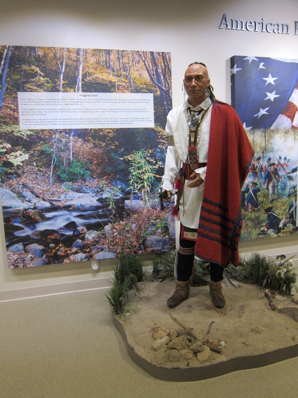
Dragging Canoe led the attack at Island Flats
|
Treaty of Long Island
|
July 1777: American Revolutionary War
In 1776, the Cherokee launched a series of attacks against the communities living west of the Proclamation Line of 1763 near the Holston, Nolichucky, and Watuaga Rivers in what is today Northeast Tennessee. The Cherokee were on the losing end and in peace negotiations conducted near the Long Island of the Holston, they relinquished lands west of the Upper Unakas controlled by the European settlers. Further Links: NPS.gov: Treaty of Long Island Jefferson West.unl.edu: Treaty with the Cherokee And North Carolina |

View of the Holston River near the Long Island in downtown Kingsport
|
Jonesborough
1779: Jonesborough was chartered in 1779 by North Carolina and is the oldest town in Tennessee and Washington County's seat of government. The town was briefly the capital of a failed state named for Benjamin Franklin and site of the first pamphlets published exclusively on the issue of abolition during the 1820s. However Jonesborough, like Sullivan County, was an outlier of pro-secession sentiment surrounded by a majority of Unionists in Northeast Tennessee during the Civil War era.
Further Links: Tennessee Encyclopedia: Jonesborough by Carroll Van West Historic Jonesborough: History of Jonesborough |
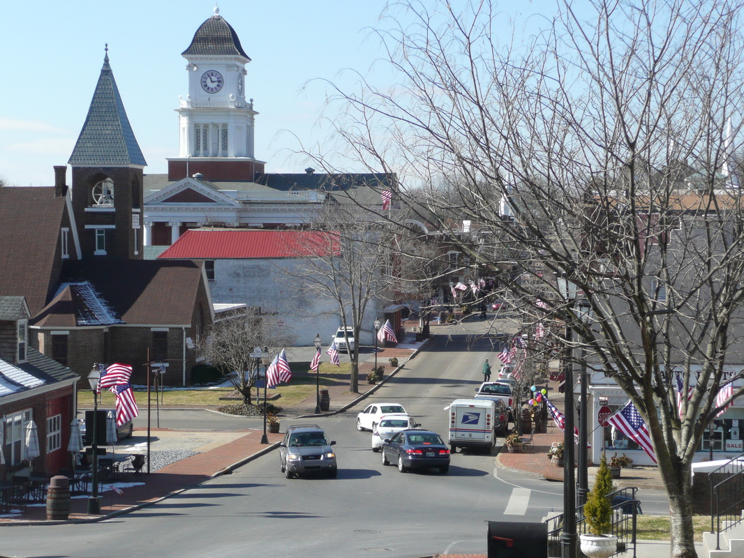
Downtown Jonesborough
|
Flotilla to Nashville
December 1779: Westward Expansion
An expedition led by Col. John Donelson traveled the Holston, Tennessee, Ohio, and Cumberland Rivers, journeying a 1,000 miles before linking up with a land expedition led by James Robertson at the French Lick, what is today Nashville. The expedition began from Fort Patrick Henry, which was built on the Long Island. Further Links: Tennessee Encyclopedia: John Donelson by Anne-Leslie Owens TN.gov: John Donelson's Journal 1779 NPS.gov: Treaty of Long Island |
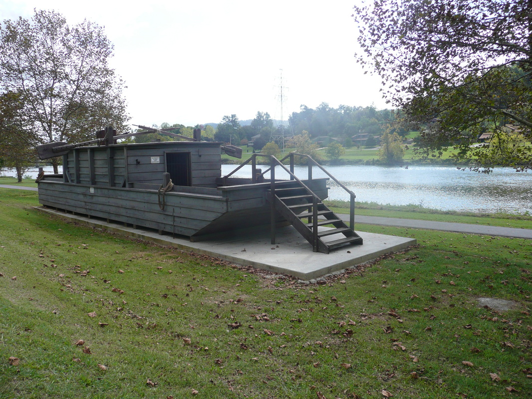
Historic Boatyard
|
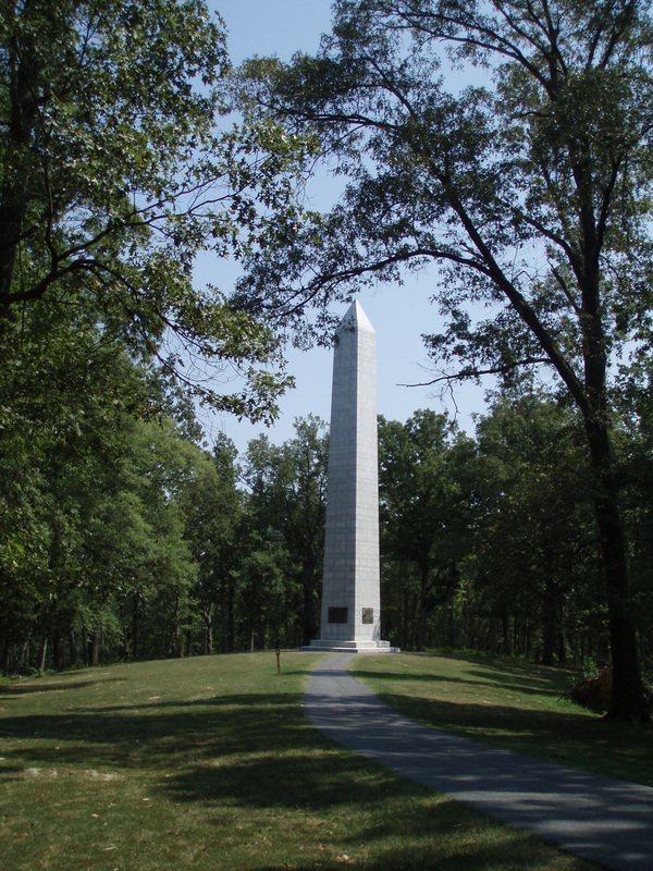
Battle of Kings Mountain
1780: American Revolutionary War
For the early settlers to the region like the Watuagans, relations with the Cherokee were already tense and complicated before the Revolution. Longhunters like Daniel Boone in a way fell in line or at least did not deeply disturb the Cherokee way of life, but the lifestyle of the settlers brought the two cultures in conflict, often violent conflict. Men like John Sevier earned their reputations as warriors in fights with the Cherokee prior to the American Revolutionary War. When war with the British broke out, the Cherokee allied with King George, their long time ally of previous conflicts against the French and the Creek. In the heart of Cherokee territory, over the mountains & beyond the protection of colonial forces, the Watuagans and other communities were left to fend for themselves. So this region is largely absent from the central story line of struggle against the British military, with the glaring exception of the Battle of Kings Mountain. Lord Cornwallis' western flank of his southern forces consisted of loyal colonists led by Major Patrick Ferguson, an officer in the British Army. Major Ferguson's actions on the western frontier of South Carolina and North Carolina alarmed the communities of Northeast Tennessee, as well Western North Carolina & Southwest Virginia. In response to a call for help and in reaction to the possible danger posed by Ferguson, nearby communities mustered a militia, meeting near Ft Watuaga at the Sycamore Shoals. The force mustered at the Sycamore Shoals have since been known as the Overmountain Men. Led by Colonels William Campbell, John Sevier, Isaac Shelby, and Charles McDowell, the Overmountain Men traveled from Fort Watauga following Gap Creek, climbing over Yellow Mountain Gap known at the time as Bright's Trace, descending down to the North Toe River following Roaring Creek before turning south and linking up with North and South Carolina Militias in search of Ferguson's Tory Army. Ferguson retreated south choosing King's Mountain as an advantageous terrain to do combat with the militias and the Overmountain Men. Like Chamberlain's bayonet charge on Little Round Top at Gettysburg, the sheer audacity of the Overmountain Men and the Militias' action of violence in attacking Kings Mountain overwhelmed their opponent. By the end of the battle, 225 loyalists were dead including Major Ferguson. 163 more were wounded and 715 had been captured. In comparison, 28 patriots were killed and 68 wounded in the battle. The Overmountain Men were at the disadvantage in lacking muskets but managed nicely with their rifles. Rifles had not yet caught up technologically in reloading speed. The victory effectively ended the Southern Campaign of the War, handing victory to a Quaker and maybe the Continental Army's best tactical mind, General Nathaniel Greene. The Battle of Kings Mountain was a significant moment in the War, a breaking point in Britain's attempt to keep the Colonies. Further Links: Kings Mountain National Military Park Sycamore Shoals State Historic Site Revolutionary War Archive: Battle of Kings Mountain by Mel Hankla Overmountain Victory National Historic Trail |
Memorial commemorating the Battle of Kings Mountain in 1780.
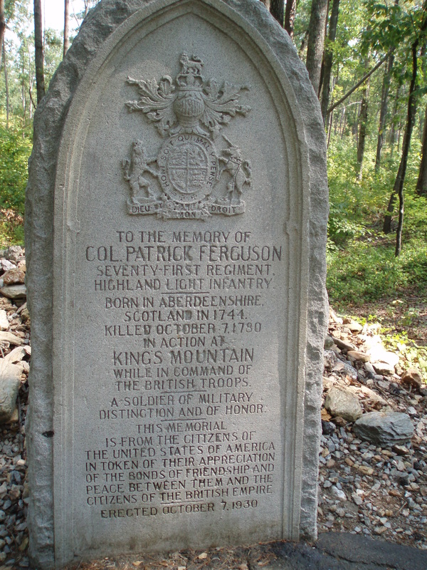
Memorial to Major Patrick Ferguson, Commander of the Tory Forces & the only British Regular to participate in the Battle of King's Mountain
|
Land Grants & Revolutionary War Veterans
1780s: An outcome of the war fought for independence was that the new nation and its individual states were deeply in debt. Among those owed were those who served against the British. Like the federal government & other states, North Carolina offered many Veterans land grants as payment. Often these lands were on the frontier, for instance Northeast Tennessee.
Further Links: Tennessee State Library & Archive: Land Grants Library of Virginia: Revolutionary War Bounty Warrants Tennessee Encyclopedia: Land Grants by Irene Griffey |
|
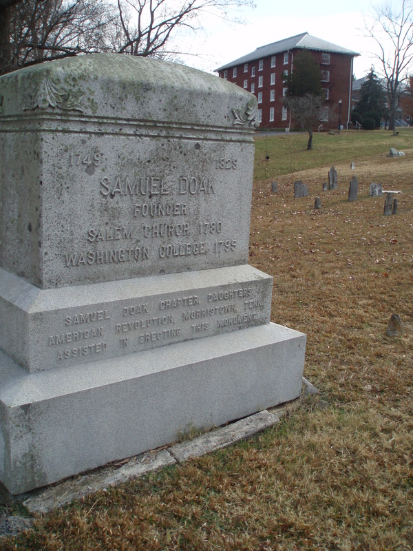
Religion in the First Frontier
The Presbyterians were among the earliest denominations to minister to the region. The incredible Presbyterian Minister Samuel Doak was among the first to reside on a permanent basis in what is today Tennessee. In addition to founding Salem Presbyterian Church and St Martin's Academy (Washington College) in Limestone, TN, Samuel Doak was a founder of the New Providence Church in Surgoinsville, as well as temporarily holding service at the Big Springs in Greeneville until Hezakiah Balch took over on a permanent basis in what became the First Presbyterian Church.
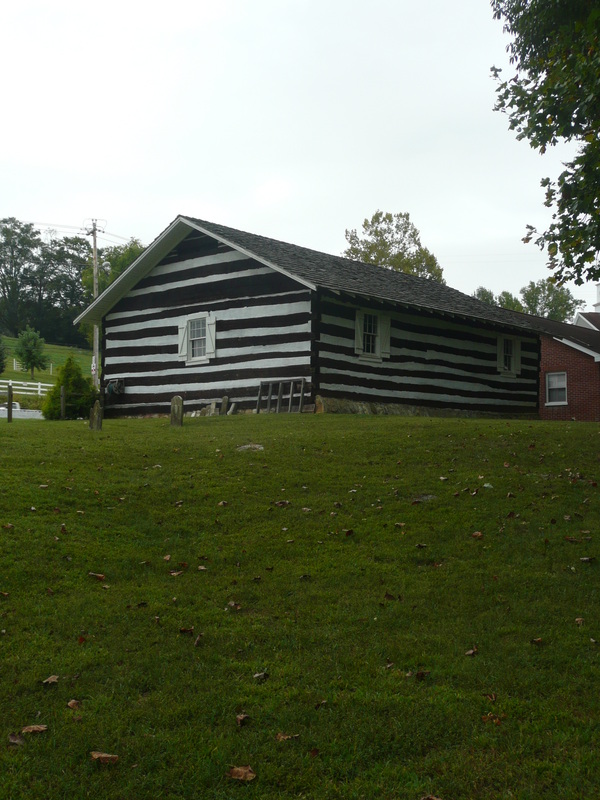
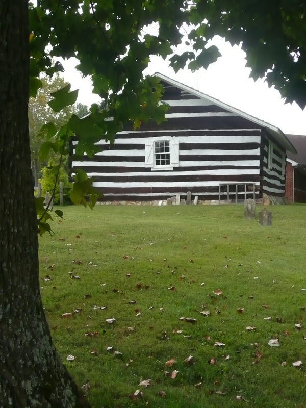
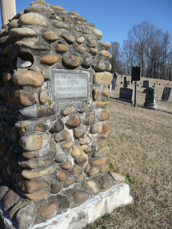
The Presbyterians were quickly followed by the other denominations like the Baptists, Methodists, & the Church of the Brethren. Though never as significant in number as the other denominations, the Quakers, also known as the Friends of Society made their presence felt in the region. The most popular denominations in Northeast Tennessee have been the Presbyterians and the Baptists. Tidence Lane was the first Baptist Pastor to serve in Tennessee. He founded Buffalo Ridge Church circa 1779 in modern-day Gray. Pastor Lane was also a central figure in organizing the Cherokee Meeting House and the Holston Baptist Association located just outside of Jonesborough near Cherokee Creek, not far from the Nolichucky River. In the decades following the American Revolution, from circa 1790 - 1830 CE, the United States underwent a religious transformation known as the Second Great Awakening. Before the 1790s, the dominant Christian denominations in the U.S.A. were Anglican (Episcopalian), Congregationalist, and Presbyterian, but by the end of the 1830s, new evangelical denominations such as the Baptists and Methodist had become the dominant Christian traditions of the young nation. The Second Great Awakening was in a sense both a religious revolution against the cold rationality of the Enlightenment Era and Deism, as well as being an inheritor of the Enlightenment's value in the individual. In some instances, the rejection of Predestination and the significance placed on the individual's emotions in their faith also suggests the Second Great Awakening was a transition from Calvinist beliefs on the wretchedness of most human being's souls to a more optimistic view of the human spirit. Among the reasons the new wave of evangelical denominations, particularly the Baptists and Methodists burgeoned with adherents, was that they effectively ministered to settlers on the ever-expanding western frontier, including the first frontier just west of the Appalachians in areas like Kentucky and Tennessee. The Methodists' success was associated with their great organization, while the Baptists selected ministers from the frontier settlers who had a calling to the Bible. Besides being tireless riders traveling to distant communities, Methodist and Baptist Ministers set-up temporary tent sites where disperse settlers came together over several days to participate in a variety of emotive religious experiences like singing and dancing, or becoming engrossed by compelling testimony. This practice became known as Camp Meetings. Regionally, historical markers notate places like Brushy Creek near present day Carvers Park in Johnson City as a Methodist camp meeting site dating back to 1811. Of course, camp meetings remain a vital ritual still practiced, in particular in the South and out West. The roots of social activism in caring for the downtrodden and also the Temperance Movement come out of the Second Great Awakening. Women played significant roles in this new social activism. The experiences of women during the Temperance Movement in gaining confidence in their political voice aided in their struggle for Suffrage. The values of the Temperance Movement eventually led to many of the counties making up the Southern Appalachians to prevent the sell of alcohol. These 'Dry Counties' later became the source of fantastic yarns about moonshiners and moonshine runs. The moonshine runs & the drivers who outran the law on dangerously, curvy mountain roads between states like North Carolina and Tennessee have since been immortalized by film & television, as well as being a piece of the legend of early stock car drivers. Further Links: Learn NC: The Second Great Awakening Tennessee Encyclopedia: Religion by Paul Conkin Tennessee Encyclopedia: Washington County by Mildred Kozsuch Tennessee Encyclopedia: Sullivan County by Blythe Semmer |
Memorial to Samuel Doak, founder of Washington College and Salem Presbyterian Church in 1780 in Limestone, TN.
Acuff Chapel was the 1st Methodist Church founded in Tennessee in 1786
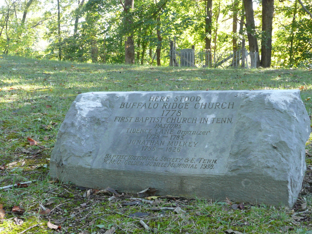
Monument commemorating Buffalo Ridge Church, the first church built in Washington County in 1779
Sinking Creek Baptist Church
|


St Martins Academy
|
1783: The Presbyterians were among the first to minister to the early settlers of the region. They were reputed for their endurance and the long distance they traveled on horseback to minister to the needs of distant frontier communities.
Besides founding many churches in the area and giving the sermon at the muster site of the Overmountain Men at the Sycamore Shoals near Ft Watuaga, Samuel Doak, a graduate of the College of New Jersey (modern day Princeton), also founded St Martin's Academy in 1783 which would later become Washington College in 1795. Further Links: Tennessee Encyclcopedia: Samuel Doak by E. Alvin Gerhardt Jr Tennessee Encyclopedia: Tusculum College by E. Alvin Gerhardt Jr |
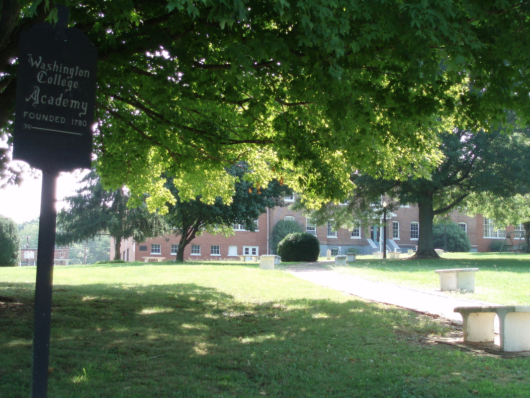
Washington College Academy was founded by Samuel Doak
|
Lost State of Franklin
1784-1789: Even before the American Revolutionary War & Independence, the communities on the western frontier felt their interests were under-represented by decision-makers on the Atlantic coastline. In the instance of this region, an early attempt at statehood named for Benjamin Franklin ultimately failed after four years.
The push for statehood gained in credibility and steam after John Sevier joined the fray in support of separating from North Carolina to create the new state of Franklin. Sevier's support brought with it enemies like the influential Tiptons who opposed statehood. Both North Carolina and Franklin had elected officials representing this region during the four years of Franklin's existence; however Franklin was never recognized as a State by the United States. Despite the failure of Franklin and a related arrest in North Carolina, John Sevier would later become the first governor of Tennessee. Approximately 80 years later, Andrew Johnson unsuccessfully pursued statehood for East Tennessee and possibly other surrounding mountain regions to be called Frankland. Further Links: Tennessee Encyclopedia: John Sevier by Robert Corlew Tennessee Encyclopedia: Lost State of Franklin by Michael Toomey |
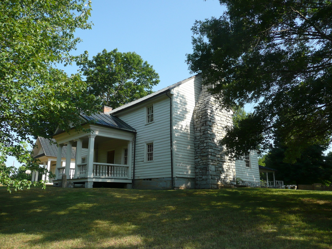
Tipton-Haynes House
|
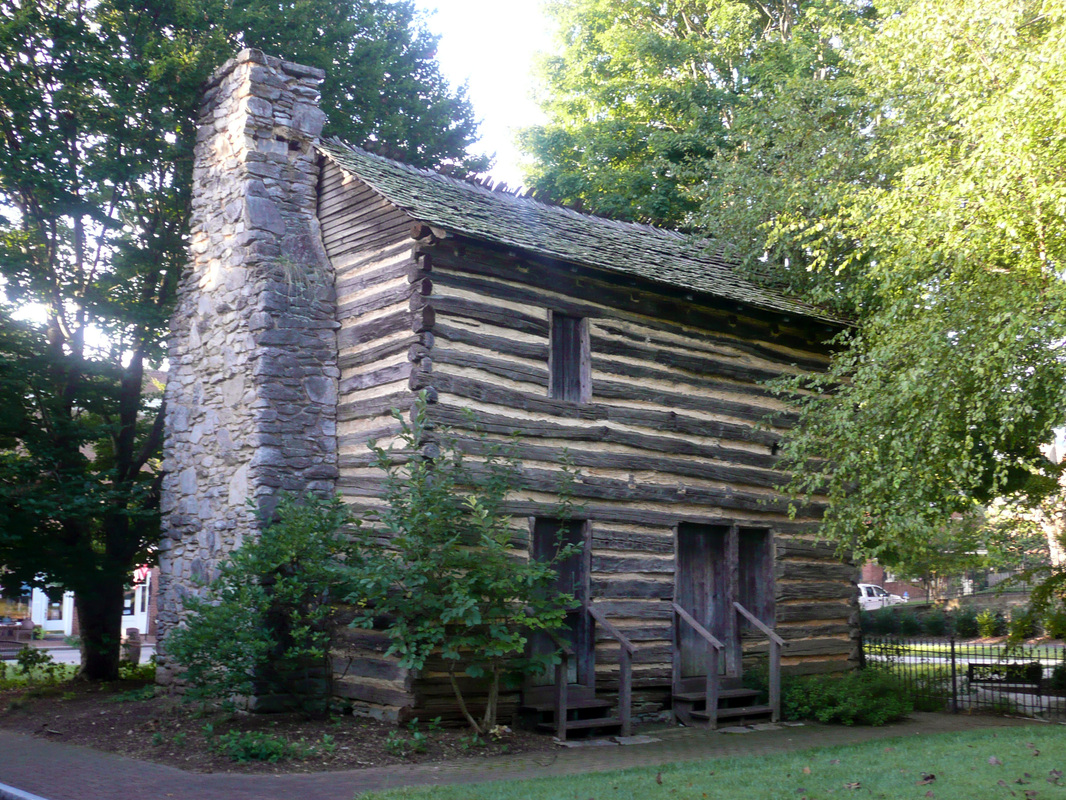
David Crockett
|
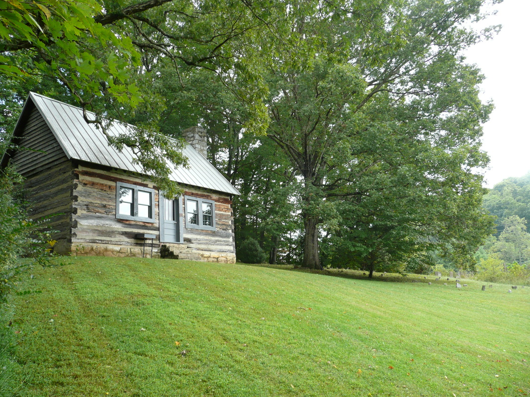
1786-1836: The legendary frontiersman and politician who fought and perished at the Alamo, David Crockett began life near the community of Limestone, TN and the Nolichucky River in 1786.
The Crocketts were among the earliest settlers to the region. David's grandparents died in an Indian attack and are buried in Rogersville, TN. David's father ran a tavern in Morristown. However, David Crockett became a larger than life figure after moving away from the east to western Tennessee. Further Links: Tennessee Encyclopedia: David Crockett by Michael Lofaro TAMU.edu: David Crockett by Michael Lofaro |
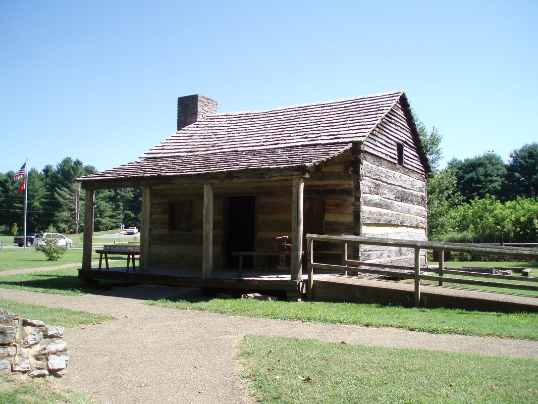
Replica Cabin at Davy Crockett's Birthplace State Park
|
Battle of Flint Creek
|
09 January 1789: The Battle of Flint Creek was one of the final acts in the story of the Lost State of Franklin. In 1788, the Chickamauga were once again causing havoc in Northeast Tennessee. Dragging Canoe and others led assaults into the area on targets like isolated homes, looking for weak spots to cause damage with minimal resistance. They then would return south, back to Cherokee territory, to their homes.
John Watts, a Chickamauga war leader, decided to camp for the winter at Flint Creek, in what is today known as the Rocky Fork. From Flint Creek, he conducted his raids. On 09 January 1789, the frontier militia commanded by John Sevier learned John Watts' Camp was located roughly 25 miles from their own location near the Nolichucky. That same day, Sevier led his men through heavy snow to the mouth of the Rocky Fork, dividing his forces up into two main groups. The 1st group set up a perimeter behind the encampment, while the 2nd group surged up Flint Creek, but not before unloading the grasshopper cannon. Damp ammo pouches from the long, snowy march and an effective counter-fire by the Chickamauga led John Sevier to an in-game change in tactics, calling for his men to switch from firearms to hand to hand combat using sword and tomahawk. Sevier's victory was resonant. The Chickamauga who were not killed or wounded, were forced to retreat, while Sevier's forces suffered minimal causalities in comparison. The battle site has good potential of becoming an interpretive trail as a part of the developing Rocky Fork State Park. Further Links: Benning.Army.mil: Battle of Flint Creek, 1789 by CPT Erick Waage |
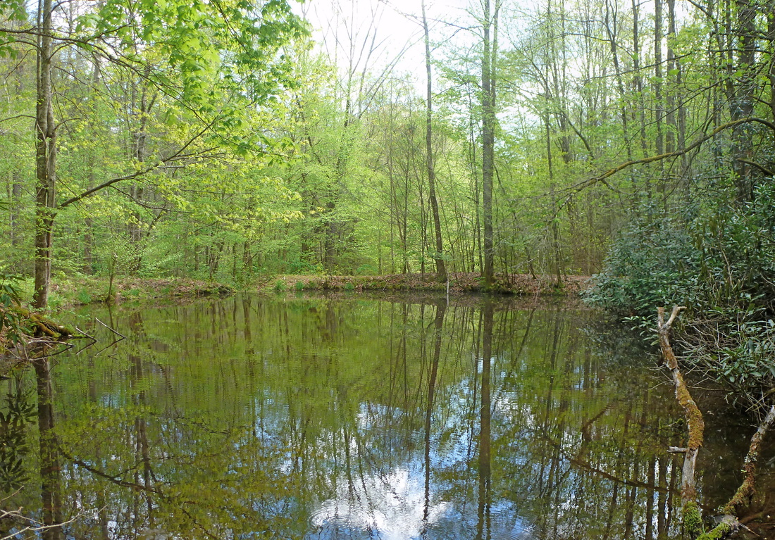
A Pond in the Rocky Fork located close to where the Battle of Flint Creek occurred
|
Rocky Mount State Historic Site
1790-1792: Southwest Territory
In 1789, North Carolina ceded lands south of the Ohio River to the federal government which in 1790 became the Southwest Territory as enacted by Congress. With the exception of allowing slavery, the Southwest Territory was governed under the same principles of the earlier created Northwest Territory. George Washington appointed William Blount as Governor of the Southwest Territory. For two years, William Blount served as Governor from the home of William Cobb located near the Watuaga River before moving to Knoxville. Cobb's home is now known as Rocky Mount and is a State Historic Site located near Piny Flats. Further Links: Tennessee Encyclopedia: Southwest Territory by Walter Durham TNGenWeb.org: Southwest Territory Tennessee Encyclopedia: William Blount by Terry Weeks Rocky Mount Living History Museum |
Rocky Mount
|
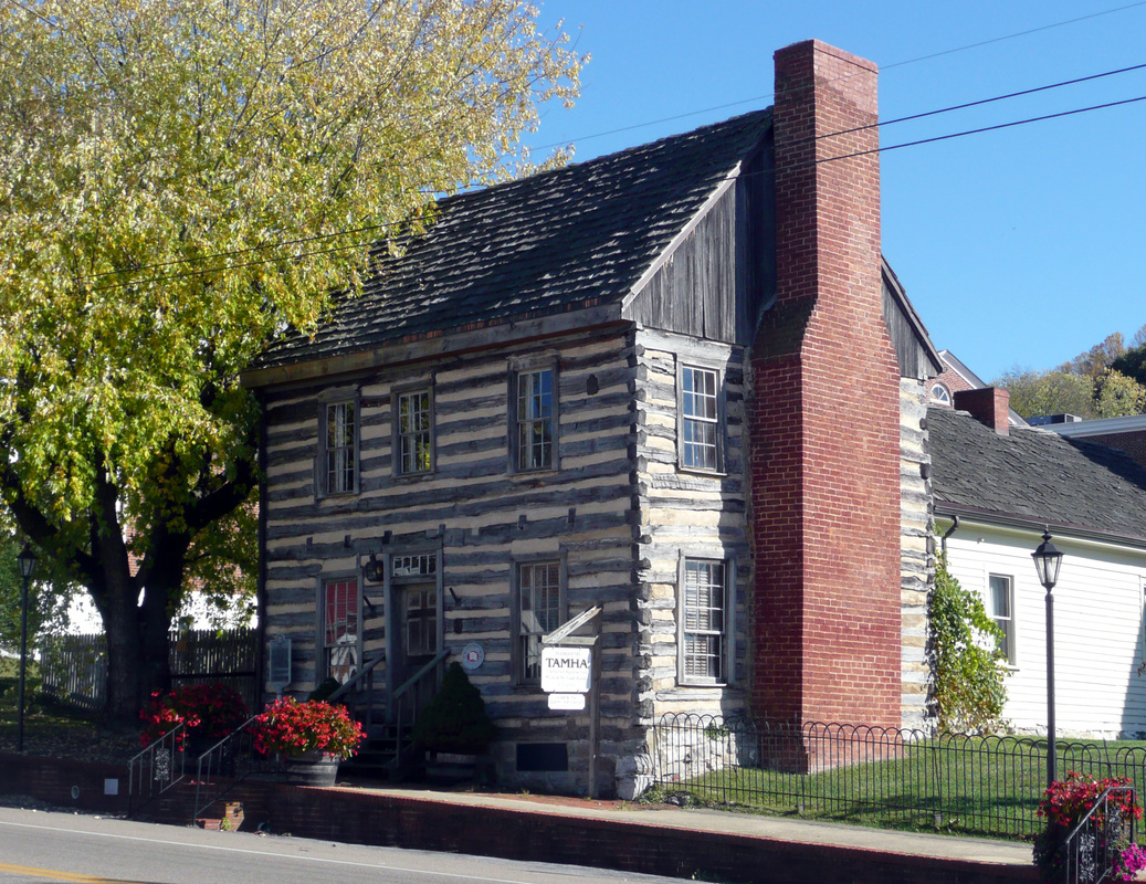
Tusculum College
1794: Samuel Doak's son, Samuel Witherspoon Doak, graduate of St Martin's Academy, following in his father's footsteps started the Tusculum Academy. The Tusculum Academy merged with Greeneville College to become Tusculum College, the oldest college in Tennessee, chartered by the Southwest Territory's legislature in 1794. Greeneville College was founded by the Presbyterian Reverends Hezakiah Balch and Charles Coffin.
Further Links: Tusculum College: About Tusculum College Tennessee Encyclopedia: Tusculum College by E Alvin Gerhardt Jr |
Andrew Johnson Library at Tusculum College
|
Andre Michaux
|
14 May 1795: The renown French Botanist Andre Michaux traveled through Tennessee on a number of occasions from 1789 to 1796 and is reported to be the first professionally trained scientist to visit the region.
On his last visit to the United States, he stayed at the Tipton House on 14 May 1795 near the start of his journey and also on 20 March 1796 as he was returning back to Charleston from his expedition. Michaux died six years later in 1802 in Madagascar. He cataloged over 250 species of plants during his exploration of the Carolinas. A small fraction of the species Michaux discovered in the Carolinas for Europe are pictured to the right in a slideshow. Further Links: Tipton-Haynes Historic Site: Andre Michaux Michaux.org: Brief Biography Michaux.org: The Carolina Plants of Andre Micaux |
|
Tennessee Becomes the 16th State
01 June 1796: Southwest Territorial Governor William Blount was among the key players in getting a contentious Congress to grant statehood to Tennessee in 1796.
Further Links: Tennessee 4 Me: Statehood Tennessee Dept of State: State History Timeline Tennessee Encyclopedia: Government by Robert Jones |
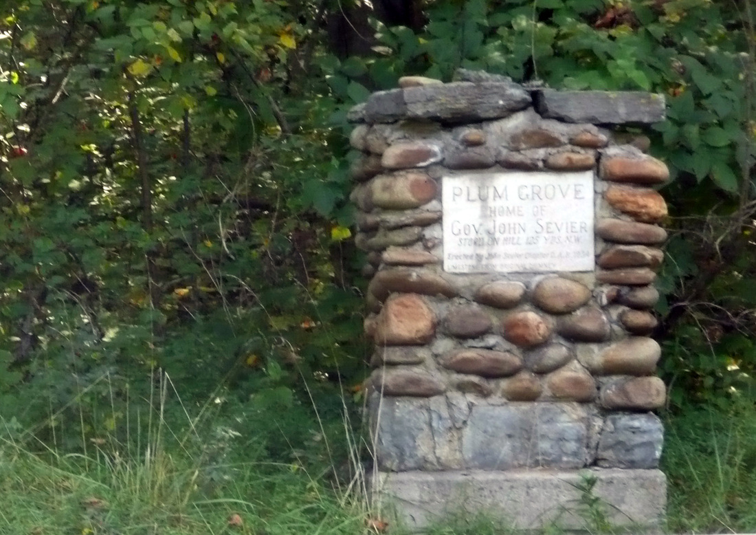
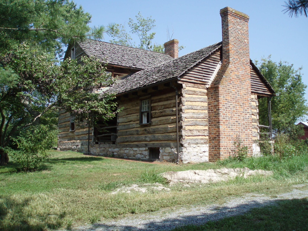
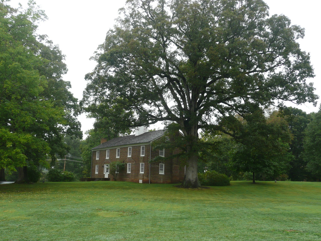
John Sevier moved from his home on the Nolichucky River called Plum Grove to a home called Marble Springs in Knoxville, where he later served as Tennessee's 1st Governor
|
War of 1812 & the Creek War of 1813-1814
1812:
Further Links: Tennessee Encyclopedia: War of 1812 by Thomas Kanon Tennessee Dept. of State: Regimental History of Tennessee Units During the War of 1812 Tennessee State Library & Archives: The Volunteer State Goes to War: A Salute to Tennessee Veterans - War of 1812 and Indian Wars Lat34North.com: Samuel McSpadden PBS.org: A British Perspective on the War of 1812 MTSU.edu: Primary Source Set - War of 1812 |
During the War of 1812, Samuel McSpadden produced gunpowder, sending it downriver, eventually reaching American Forces to the west. McSpadden's home is pictured above.
|
First Abolitionist Publications
|
1819-1820: The Emancipator was the first newsletter published in the United States exclusively on the issue of Abolition. The newsletter was published in Jonesborough, TN by Elihu Embree.
From the Emancipator (31 May 1820): 'The practice of reducing our fellow men to a state of abject slavery, is so repugnant to the principles of the Christian religion, that we are surprised when we see men enjoying all the blessings of a republican government - men who have been justly renowned for their love of liberty - who have been instrumental to rearing a temple to FREEDOM, whose basis covers an extensive continent, and whose summit reaches the clouds - men who in other respects appear to wear the garb of justice, exercise this unjust and impolitic practice, in direct opposition to republicanism, and the whole tenor of the gospel ! ! Finally, we cordially request our fellow - citizens, and particularly ministers of the gospel of every denomination, and members of the legislatures, to espouse the cause of humanity - to make every exertion consistent with the dignity of this profession and station, to promote the glorious work of undoing the heavy burdens, and letting the oppressed go free.' -Elihu Embree Further Links: Tennessee Encyclopedia: Manumission Intelligencer & Emancipator by Tara Mitchell Mielnik University of Tennessee Digital Library: The Emancipator Newsletter Tennessee Encyclopedia: The Emancipator by Tara Mitchell Mielnik |

The Embree House near Limestone, TN
|
Clarksville Iron Furnace
|
1833 -1844: Listed on the National Register of Historic Places, the Clarksville Iron Furnace was built in 1833 near where Clarks Creek flows into the Nolichucky River. Elijah Embree supplied iron ore mined from Bumpass Cove and transported the ore over the mountain to the furnace. The furnace worked until 1844 when an accident caused flooding of the furnace while iron was in the process of being smelted. In Touring the East Tennessee Backroads, Carolyn Sakowski writes despite the furnace's profitability, it was not rebuilt and the venture was likely discontinued because the business partners failed to get along.
The Embree Family were already well-acquainted with the iron industry having built an ironworks and begun mining iron from Bumpass Cove in the 1820s. In The Tennessee-Virginia Tri-Cities: Urbanization in Appalachia, 1900 - 1950, Tom Lee writes on the Embree's ironworks, "The ironworks became the largest in East Tennessee, included the second largest rolling mill in Tennessee, and employed as many as 150 workers to mine ore, refine it, and cut timber for the furnace. By 1859, iron manufacturing accounted for 26 percent of the value of commercial manufacturing in northeastern Tennessee and southwestern Virginia and ranked second only to grain processing among manufacturing industries." Lee goes on to write that despite initial optimism toward the iron industry, very poor roads made transporting local product to national markets difficult. Because of this, the iron industry largely just met the needs of the region and the lack of competition from the national market led to a stagnation in the method and quality of iron being produced locally. This stagnation became a real disadvantage as the local economy became more open with the coming of the railroad and improved transportation. Further Online Resources: Waymarking.com: Clarksville Iron Furnace |
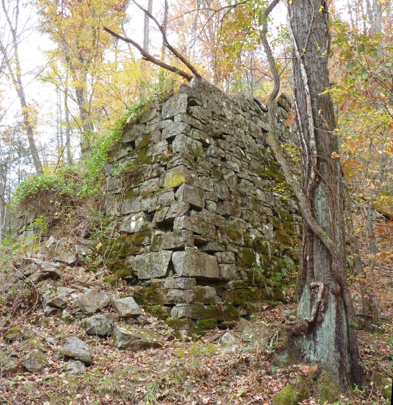
The Clarksville Iron Furnace was built in 1833
|
Trail of Tears
|
1838-1839: After the United States gained independence from the British, the Cherokee for the next 50 years or so found themselves negotiating with the very young nation almost annually, each treaty signed bringing the loss of their territory, one big chunk at a time.
In the struggle to hold on to what traditional lands they had left, the Cherokee made some remarkable changes to their society. The pressure wrought by individual states and the federal government had already united the Cherokee into seeing themselves as a nation. They changed their government to a two-house legislature from a council. In the late 1820s, the Cherokee developed a constitution and elected a head of state, John Ross. They also converted to Christianity. The warrior Sequoya, native of the Overhill Towns, developed a written language for the Cherokee in 1821. By 1828, Elias Boudinot began publication of the Cherokee Phoenix, a newspaper printed in both Cherokee and English. All these changes happened rapidly , beginning about a decade after the death of the United States first Secretary of War Henry Knox, who died in 1806. General Knox was a strong proponent of treating the Native Americans in a manner reflecting the enlightened principles fought for during the American Revolution. He hoped to induce Native Americans to recreate their societies in the image of the United States. In doing so, tribes like the Cherokee would require less territory, moving away from hunting to raising livestock . They then would sell a majority of that land to the United States for a profit that could be reinvested. General Henry Knox's vision wasn't meant to be, even within his own lifetime. The young nation had to pick and choose what actions of its citizenry it could control, like taxing whiskey and the actions it couldn't stop, like the steady progression onto tribal territories. As the founders gave way to a new generation, political power shifted from the coastline to the frontier, maybe best symbolized by the election of President Andrew Jackson, a Middle Tennessean with an impressive reputation as a military commander during the War of 1812 and against the Creek. President Andrew Jackson was no friend to Native Americans, even to his Cherokee allies in the wars against the Creek and the British. He signed the Indian Removal Act in 1830. The Creek, Chickasaw and the Choctaw were forced west just a few years after the ink dried. The Cherokee chose to fight their forced expulsion through the courts. The state of Georgia was their fiercest opponent, having been promised the Cherokee Territory in modern-day Northern Georgia by President Thomas Jefferson in 1802, in exchange for western territory Georgia claimed. The discovery of gold on Cherokee lands only made Georgia fiercer in getting them removed. In 1835, a fracture group of the Cherokee led by Major Ridge and Elias Boudinot believed expulsion from their ancestral lands was inevitable. They disagreed with the majority of Cherokee led by John Ross, who despite losses suffered in court and being robbed of property without consequence at home still wished to fight. Major Ridge's contingent, a clear minority signed the Treaty of New Echota, relinquishing what lands the Cherokee had left East of the Mississippi. The fracture group then headed west to a reservation in modern-day Oklahoma, where previous Cherokee had settled having earlier accepted expulsion. The majority of Cherokee continued the struggle to hold onto their lands but by 1838, General Winfield Scott was given the order to remove the Cherokee by President Martin Van Buren. The forced migration was conducted over several iterations. Many began the journey from a prison camp, having been arrested with barely the clothes on their back left as personal possessions. Exact numbers are unknown, but an estimated 20% of Cherokee died on the journey west from a number of causes, including malnutrition, over-exertion, cholera, and other diseases. The expulsion has since been known as the Trail of Tears. Not long after their arrival, supporters of John Ross assassinated Major Ridge, John Ridge, and Elias Boudinot for their parts in the Treaty of New Echota, which erupted a bloody civil war lasting more than a decade between Cherokees settled out west. Some Cherokee managed to escape expulsion, many by hiding deep in the Blue Ridge Mountains. Those who were not caught and sent west, eventually came to be recognized as the Eastern Band of the Cherokee, their reservation located near Great Smoky Mountains National Park in North Carolina. Further Links: NCPedia.org: Cherokee Indians Part 5: Trail of Tears & the Creation of the Eastern Band of Cherokees Cherokee.org: A Brief History of the Trail of Tears OKState.edu: Indian Affairs: Laws and Treaties OKState.edu: Treaty of New Echota 1835 Digital History: Indian Removal Timeline Cherokee.org: Cherokee Timeline |
President Andrew Jackson stayed at Maj Christopher Taylor's home while studying law at Jonesborough, Tn
|
Nashville becomes the State Capital
|
1843: Tennessee became a state in 1796 and for nearly 50 years a number of cities acted as the state capital, including Knoxville, Nashville, Murfreesboro and Kingston. In 1843, the Tennessee legislature made Nashville the state capital permanently. Nashville becoming the capital symbolized a truth to many East Tennesseans of their decline in both political and economic power, in particular in relation to the rise of Middle Tennessee. They felt the interest of wealthy slave-holders in Middle Tennessee were disproportionately considered, while investment in East Tennessee was deeply neglected. Political animosity between the two regions, along with the mountainous geography, factored into East Tennessee remaining aloof from melding into a homogenous statewide identity.
Further Links: Nashville Historic Inc: History Tennessee Encyclopedia: Government by Robert Jones |
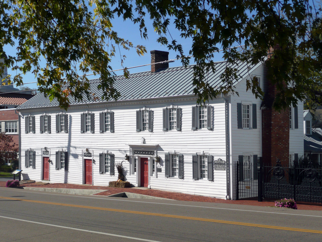
The Deery Inn located in Blountville hosted three US Presidents, Presidents Andrew Jackson, James Polk, and Andrew Johnson.
|
Bristol, TN/VA
|
1856: The land that eventually became Bristol was settled by General Isaac Shelby in the late 1760s. Shelby, a Veteran of the French and Indian War and a commander at the Battle of Kings Mountain, named the area Sapling Grove. Shelby would go on to be Kentucky's first governor in 1792.
Col. James King, Veteran of the American Revolutionary War, purchased the land from Isaac Shelby and built a sawmill and an ironworks. His son, Reverend James King inherited the land after the Colonel's death and he would later impart a portion of the property to his son-in-law, Joseph Anderson. Joseph Anderson, a merchant in Blountville, acquired the land to build a city he would name Bristol, having learned the area was likely to be a junction of two railroads. Construction of Bristol began in 1853 and the city was incorporated in 1856. The Virginia side of Bristol, the area north of Beaver Creek was owned by Samuel Goodson and in the same year Bristol, TN was incorporated, so to was Goodson, VA. However, the railroad depot in Goodson continued to be called Bristol and in 1890 Goodson officially switched names to Bristol. Further Links: VisitBristolTnVa.org: History of Bristol BristolTn.org: History of Bristol Tennessee Encyclopedia: Sullivan County by Blythe Semmer |
Joseph Anderson lived in Blountville at this Townhouse before moving to found Bristol, TN
|
East Tennessee & Virginia Railroad
1858: Chartered in 1848, the East Tennessee and Virginia Railroad was completed in 1858, connecting Bristol to Knoxville. The route was apart of the greater Virginia and Tennessee Railroad, which reached Washington DC from Bristol, and Atlanta from Knoxville.
The railway was deeply influential in the development of the Tri-Cities, TN. In 1854, Henry Johnson built a post office, store, and depot at the intersection of a stage road and the proposed railroad route. The area would come to be called Johnson's Tank, then Johnson's Depot, and not long after the Civil War, Johnson City. During the Civil War, the Virginia and Tennessee Railroad was a target of massive sabotage by Unionists involving the synchronized destruction of bridges along the railroad's route from near Bristol to Chattanooga, TN. The railroad was a major logistical and communication line between Virginia and the deep south. Further Links: Tennessee Encyclopedia: Johnson City by Jean Haskell Tennessee Encyclopedia: Railroads by Edward Johnson Carole Family Tree: Ties between Railroad, City have Deep Roots by Ed Speer |
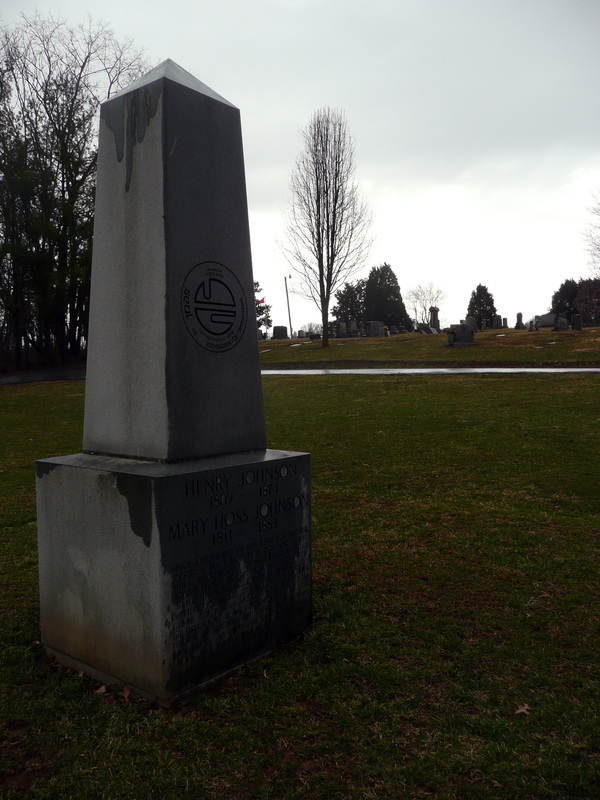
Memorial commemorating the founders of Johnson City, Henry and Mary Johnson who built a shop, depot, and post office nearby in 1854
|
