Horse Creek, Old Forge, & Round Knob:
 Squibb Creek Falls is located in Horse Creek
Horse Creek Recreation Area is located in a cove in the shadow of Cold Spring Mountain in Greene County and is the source of many great hikes. Horse Creek has a picnic area built by the CCC as well as 15 campsites, six are tent sites and nine are RV sites.
The camp sites are first come first serve and there is a $10.00 per night fee for use. The picnic site pavilion can be reserved for day-use by contacting the Unaka Ranger Station.
The Old Forge Campground was also built by the CCC and is accessible from Horse Creek by both vehicle and trail. The campground has ten (10) tent camp sites that are $7.00 per night. Old Forge is the source of three (3) trails that makes a nice loop hike, with a nice stop to visit the CCC constructed Round Knob Picnic Area.
Horse Creek is a part of land specifically set aside as a bear sanctuary and bear encounters are as likely here as they are in the Great Smoky Mountains National Park. Blueberry bushes grow along the switchbacks of Turkey Pen Trail and I suspect this trail can be very popular for our ursine brothers and sisters.
The trails described below are: Middle Springs Trail-to-Turkey Pen Cove Trail Loop, Squibb Creek Falls Trail, Pete's Branch Falls Trail, Horse Creek Multi-Trail Loop, Little Jennings Creek Trail, and the Late May Flower Hike (Round Knob to Firescald Ridge).
Further Online Resources:
Cherokee National Forest: Horse Creek
Partners of Cherokee National Forest: Horse Creek
|
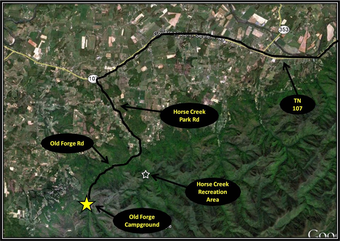
Driving Directions:
From University Parkway, take a right onto Cherokee Street. Follow Cherokee Street for 9.4 miles and turn left onto TN-81. Not long after crossing the Nolichucky River take a right onto TN-107. Follow TN-107 for about 13.5 miles before making a left onto Horse Creek Park Rd. Follow Horse Creek Park Road as it eventually leads into the campground and picnic area. Signs mark the way from TN-107.
Driving Directions to Horse Creek using Google Maps is linked here. |
Middle Springs Trail to Turkey Pen Cove Trail Loop
|
Distance: Approximately 5 miles round trip loop hike
This hike is a combination of Middle Springs Trail to Turkey Pen Cove Trail. Both trails are similar in that both are ruthlessly steep with the way becoming more difficult to navigate toward the upper portions of the routes do to some overgrowth and fallen trees. This is a loop hike with an approximate distance of 5 miles. Starting from the parking area close to Horse Creek's Picnic Area, where the road's asphalt surface ends, the hike briefly follows the forestry road before crossing the footbridge over Horse Creek. The route crosses over two more bridges before passing by a lovely A-frame cabin. After passing the A-frame cabin, the trail crosses Squibb Creek a couple of times before reaching a fork in the route. Turkey Pen Cove Trail continues straight while Middle Springs Trail and Squibb Creek Trail splits right immediately crossing a stream. Turn right crossing a stream following Middle Springs Trail. Not far past the split from Turkey Pen Cove Trail, Middle Springs Trail splits away left from Squibb Creek Trail. Wooden Signs mark where each of the trails split away. Follow Middle Springs Trail. From here the route gets steep as the trail climbs up a hillside. In May, Mountain Laurels bloom in force along the path. Huckleberries and Deerberry also grow along the route and the further the path is climbed the more dense the plant's limbs obscure the trail below. Eventually the trail makes a sharp left turn and continues to lead up a hillside. I believe this sharp left marks the transition of Middle Springs Trail into Turkey Pen Cove Trail, but this point may be further up. Keep an eye out in late May / early June for the beautiful Turkeybeard that bloom along this particular part of the hike. The route eventually begins to level out as the trail moves into deeper forest. From here the route appears to fork. Take the path that turns left and not the possible path that veers right. The path can be tough to follow at the top, so be careful. As the trail begins to lead downhill, there is a rock outcropping that provides a good resting spot and an excellent vista of nearby mountains. From here the path has some steep downhill stretches with some switchbacks. The further the trail descends, the easier the route becomes to navigate with less overgrowth obfuscating the way. There are also some small stream crossings before reaching the initial split between Turkey Pen Cove Trail and Middle Springs Trail. From here the route back is the way you came. At an approximate distance of 5 miles, this loop hike has some steep uphill and can be tough at times to navigate making for a challenging day-hike with a ranking of difficult. Further Online Resources: Greeneville Hiking Club (Current as of Spring 2013) |

I'll Be Your Huckleberry
Turkeybeard along the Turkey Pen Cove - Middle Springs Trail Loop
View from Turkey Pen Cove Trail
|
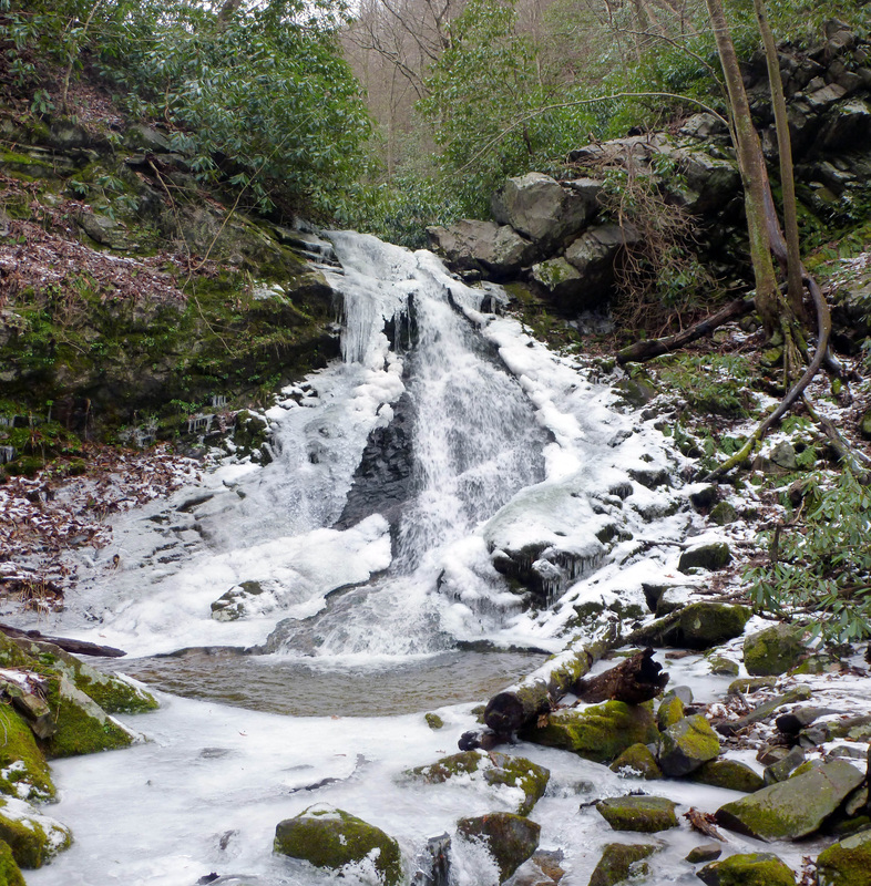
Squibb Creek Falls Trail:
Distance: Approximate 5 miles total, 2.5 miles one-way (?)
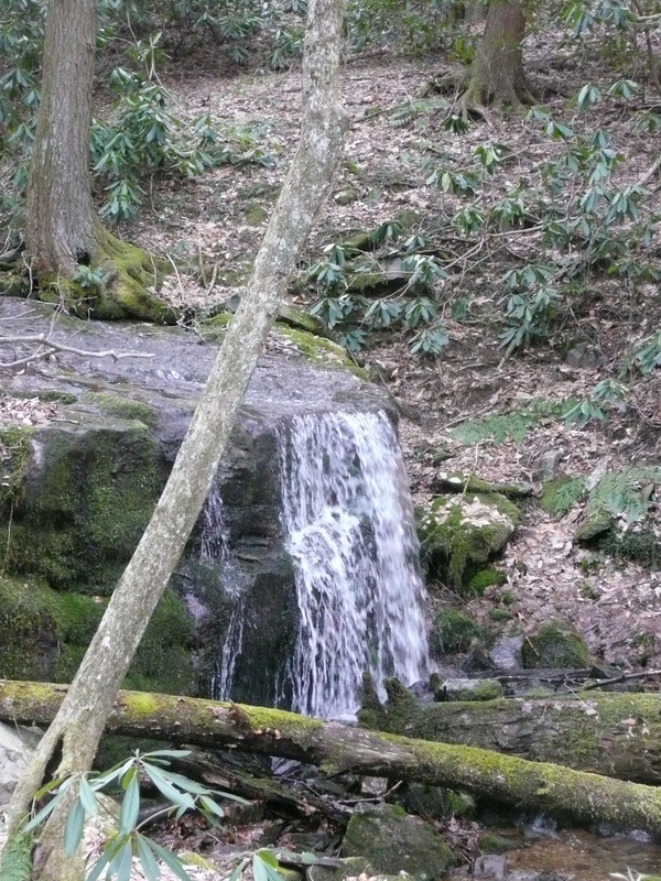
Squibb Creek Falls is another regional waterfall greatly influenced by the weather and also the season. Still, even when the water table is low, the falls are a pretty place to visit in Horse Creek, so regardless of the season this hike is worth the adventure. The path to Sill Branch Falls begins where all hikes begin in Horse Creek, near the CCC-built Picnic Area, where the paved road turns into a popular 4wd dirt forestry road. The forestry road is followed for only a short time before turning left and crossing a bridge over Horse Creek. After crossing Horse Creek, the path crosses two more bridges and by a quaint a-frame cabin before the first creek-crossing that doesn't involve a bridge. From here all the crossings will involve rock-hopping. Fortunately the crossings can be done without soaking one's socks which is pretty good because the path crosses a stream, mainly Squibb Creek, about 15-18 times on the way up to the Falls. For the most part, Squibb Creek Trail is easily navigated with maybe the exception of where the trail splits from Turkey Pen Cove Trail. It's easy to keep going straight and missing the right turn across a stream that during dry times appears to be more of a mud hole. Fortunately a few meters from the split a wooden sign marks Turkey Pen Cove Trail. Not long after passing this fairly easy navigation point, two more signs come in view. A sign to the left marks where Middle Spring Trail splits from the route. Slightly further down the other sign marks Squibb Creek Trail. From here it is just following the trail as it ascends to the waterfall. Be aware this trail is of moderate level with a constant uphill ascent to the falls with varying degrees of steepness. There are a couple of spots where the uphill gets a bit mean but only for short lengths. Distance for this hike is questionable. Kenneth Murray lists the hike at five miles round trip. Greeneville Hiking Club lists the hike at seven miles round trip and Cherokee National Forest lists the hike as 4 miles round trip. This hike is a there and back again hike. Further Online Resources: Cherokee National Forest Link Greeneville Hiking Club (Recommended) (Current as of Spring 2013) |
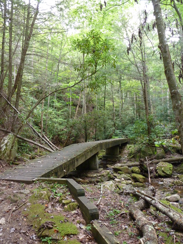
Bridge on the way to Squibb Creek Falls
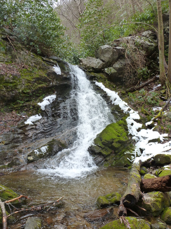
Squibb Creek Falls
|
Pete's Branch Falls
|
Distance: Approximate 4 miles total, 2 miles one-way
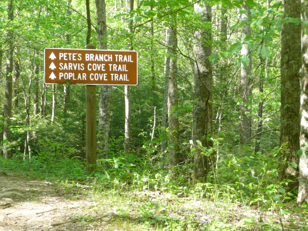
The trek to Pete's Branch Falls is 2 miles one-way or 4 miles round trip from the Horse Creek trailhead. There are twenty stream crossings when including the way back from the falls. Expect to get wet when crossing Horse Creek multiple times along the Forestry Road. The other crossings can usually be accomplished without getting wet through rock-hopping. From the trailhead, follow the forestry road, sometimes referred to as Horse Creek Multi-Use Trail for a little over a mile. A large sign marks the right turn onto Pete's Branch Trail, Sarvis Cove Trail and Poplar Cove Trail. Follow the trail to the right as it travels past a primitive camping and vehicle parking area before crossing a stream. Almost immediately after crossing the stream, Pete's Branch Trail splits left from the Poplar Cove and Sarvis Cove Trails. Continue following Pete's Branch Trail left as it leads up to the falls. The trail is continuously uphill throughout the trek to the falls with the journey getting steeper as the Falls are reached. The way back is the way you came. Like Squibb Creek Falls, Pete's Branch Falls is greatly affected by the seasons and by the weather. I do not recommend this hike during dry times. Additionally, the forestry road is challenging off-roading for those with high-clearance and 4wd. Further Online Resources: Greeneville Hiking Club (Excellent Map of Trail) Cherokee National Forest Link (Current as of Spring 2013) |
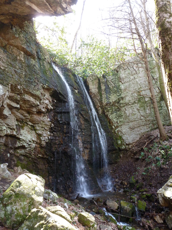
Pete's Branch Falls in Horse Creek

On the way to Pete's Branch Falls
|
Horse Creek Multiple-Trail Loop:Distance: Approximately 10 miles round trip loop hike
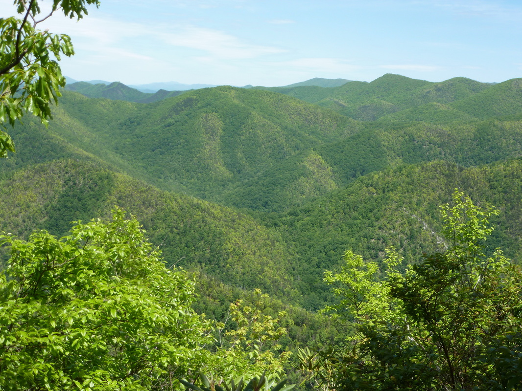
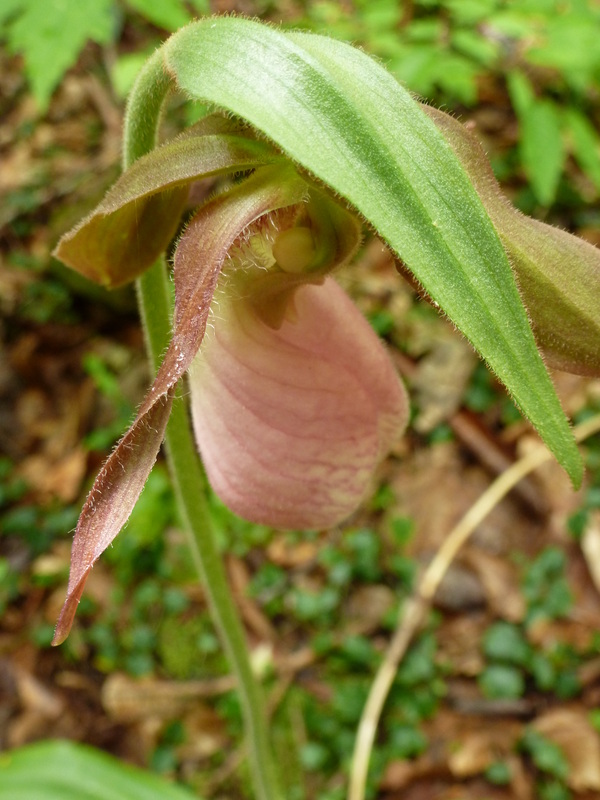
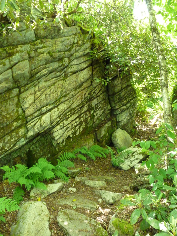
As far as day hikes go, the trek to Horse Creek Overlook byway of the Forest Service Road, Poplar Cove Trail, and Sarvis Cove Trail is among the most strenuous and rewarding hikes in the region. I do not recommend doing this hike alone if you are an inexperienced hiker. Besides the awesome view, wildflowers grow in force along this route. Trillium, Violets, Umbrella Leaf, Wild Iris, Pink Lady Slipper Orchid, Speckled Wood Lily, Southern Blackberry, Canada Mayflower, American Lily of the Vally, Great Rhododendron, Galax, Foamflower, and Mountain Laurel are but a few of the species to be found blooming during Spring. From the trailhead, follow the forestry road, sometimes referred to as Horse Creek Multi-Use Trail for a little over a mile. A large sign marks the right turn onto Pete's Branch Trail, Sarvis Cove Trail and Poplar Cove Trail. Follow the trail to the right as it travels past a primitive camping and vehicle parking area before crossing a stream. Stay straight on the Poplar Cove Trail as Pete's Branch Trail turns left after crossing the stream. From here the trail travels up before dipping a little. About a half-mile from the split with Pete's Branch Trail, Sarvis Cove splits from the Poplar Cove Trail. Stay Straight on the Sarvis Cove Trail as it ascends up a draw, following a stream for much of the trek. There are many steep stretches along the trail. Toward the top, the grade is so steep and the footing so poor it is not uncommon to feel as though for every step taken, two has been lost from back-sliding. At the base of the Sarvis Cove Trail, the forest canopy is very thick, blocking out much of the sun's light. There are many fallen tree limbs and branches to scurry around, or over along this section of the hike. Additionally, the trail can be hard to follow either from the fallen leaves or from the encroachment of the forest's plants vying for the sun's nutrition. This becomes more of a problem further up on Sarvis Cove Trail, esp. near the top of the trail, as the route switchbacks climbing toward the top of a tall rocky cliff and a garden of boulders. At the top of the rock formations is where Sarvis Cove Trail ends, as well as meets the Forestry Road. A side trail to the right leads up to the Appalachian Trail, just a very short distance away. From here follow the Forestry Road as it opens up into a moderately-sized parking area. To the right the forestry road continues further up the mountainside linking up with the Appalachian Trail. A gate prevents vehicle traffic from going further up this section of the road. On the left side of the parking area, a short path leads to the beautiful views of Tennessee offered by the rocky outcropping at Horse Creek Overlook. Next to the rock outcropping is a tombstone marking the grave of a World War II Veteran. From here the trek is all downhill for about four and a half miles. The Forestry Road is popular for those who have high-clearance vehicles, so just be aware there will most likely be some road traffic on this particular part of the trek. There are many stream crossings on this trek, dependent on the season and the water levels. Almost all can be accomplished without getting wet, with maybe the exception of crossing Horse Creek at the lower portions of the Forestry Road. Along these crossings, rock hopping may be possible, but maybe not. This is a difficult loop hike that is approximately 10 miles round trip in distance. I highly recommend reading the details of this hike as described by the Greeneville Hiking Club which is linked below. Further Online Resources: Greeneville Hiking Club (Current as of Spring 2013) |
Horse Creek Recreation Area
Sarvis Cove Trail obscured by the Echoing Green

Toad along the Way
Small Falls along Sarvis Cove Trail
|
Little Jennings Creek Trail (Starting from Old Forge)
|
Distance: 4 miles total, 2 miles one-way
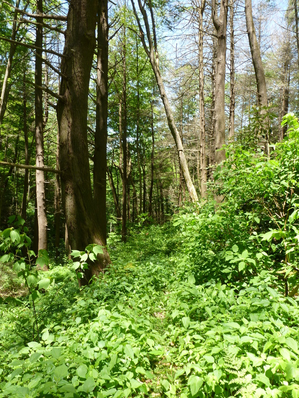
Little Jennings Creek Trail is one of the most beautiful hikes for Spring wildflowers in the region. Showy orchid, trillium, trout lily, spotted mandarin, pink lady slipper orchid, speckled wood lily, and wild iris are only a few of the many species to be found along this trail as the trek starts from Old Forge Campground following Little Jennings Creek, eventually leading to Round Knob Picnic Area. The hike begins from Old Forge Campground by crossing Big Jennings Creek. This is the deepest of the many creek crossings and is likely to soak your socks. Not long after the second creek crossing, Little Jennings Creek splits right from Big Jennings Creek Trail. From here the navigation is easy with occasional and often faded yellow blazes marking the way as the path climbs at times steeply toward Round Knob. The trail closely mirrors Little Jennings Creek for a majority of the hike and there are approximately 20+ creek crossings on the way up to Round Knob on this trail, so as a there and back again hike this route has 40+ creek crossings. Most can be done by rock-hopping but expect to get wet on this one. At a few points further up the path, the creek has rerouted and become a part of the trail. The creek is not deep where this has happened and during the summer is likely not even an issue, but just be aware. Eventually the trail will switch back to the right and the sound of the creek will fade. Not long after departing from the creek, the trail ends at a fork with the left turn leading to Cowbell Hollow and the right leading to nearby Round Knob. The wildflower display along the upper regions of the trail still remains strong but the legions of trillium have given way to galax, while speckled wood lily grow like crazy along the hillsides throughout most of the hike. Trail signs mark both Little Jennings Creek Trail and Cowbell Hollow Trail. Round Knob, like Old Forge and Horse Creek was built by the CCC in the mid-1930s and is a lovely locale to relax or picnic. This is a there and back again hike at a round trip distance of four miles, or two miles one-way. The hike is of moderate difficulty with many stream crossings and some steep stints along the way to Round Knob. As a popular multi-use trail, spots can be pot-holed and muddy from horse-back riding. The hike can be made into a loop hike by taking Cowbell Hollow Trail and then Big Jennings Creek Trail back down to Old Forge. This adds an extra mile to the hike distance. Further Online Resources: Greeneville Hiking Club (Recommended) Sherpa Guides: Upper Unakas Cherokee National Forest: Old Forge (Current as of Spring 2013) |
Pink Lady Slipper Orchid along Little Jennings Creek Trail
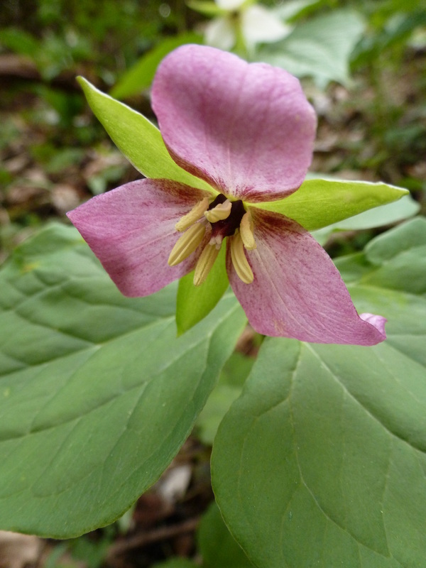
Trillium Blooming Along Little Jennings Creek Trail
|

|
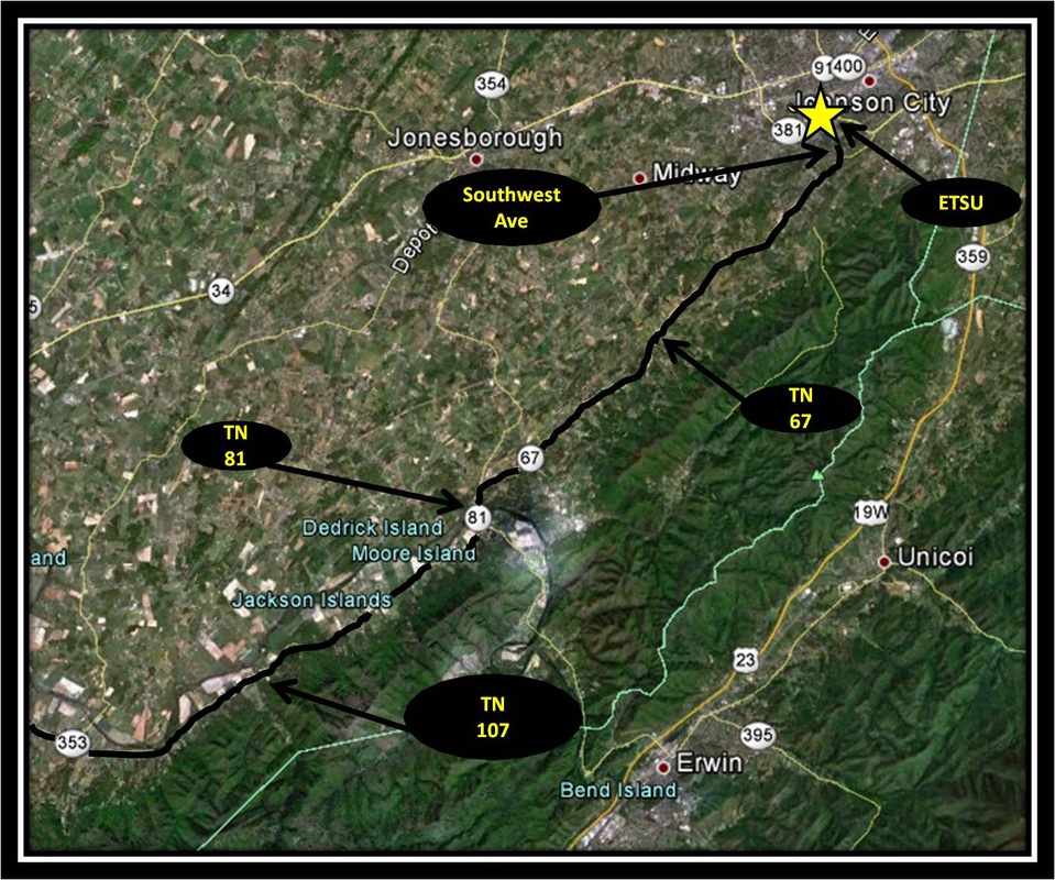
Driving Directions:
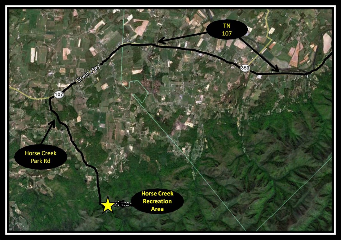
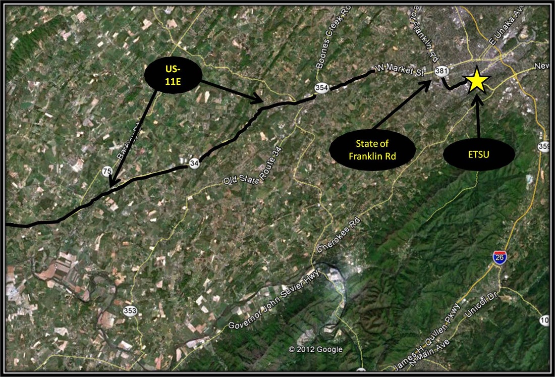
From ETSU, take Southwest Avenue turning right onto Cherokee Road (also known as TN-67). Follow Cherokee Road until its end and turn left onto TN-81. Shortly after crossing the Nolichucky River, turn right onto TN-107. Follow TN-107 for approximately 13.4 miles and turn left onto Horse Creek Park Road. A sign marks the turn from TN-107. Stay on Horse Creek Park Road as it veers right on a couple of occasions. Signs mark the way to Horse Creek.
Almost immediately after passing the sign marking the entrance to Horse Creek, turn right onto Old Forge Road. A sign marks the right turn. Follow Old Forge Road for about 2.5 miles before reaching the parking area for Old Forge Campground. Old Forge Road starts off as a hard surface but after a short while becomes a well maintained, unpaved road. During the off-season when the campground is closed, Old Forge Road may be blocked off by a horse gate about 0.8 miles from the campground. Please be aware of your driving speed no matter the season as Old Forge is a popular place for horseback riding and it's common to be sharing the road with our equine brothers and sisters. Driving directions to Old Forge Campground and the start of the hike using Google Maps is linked here. |
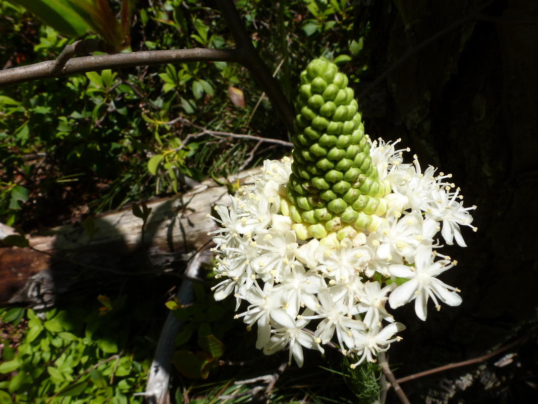
The Late May Flower Hike (Round Knob to Firescald Ridge)
|
Distance: Approximately 10 miles total, 5 miles one-way (?)
The panoramic views of the Blue Ridge Mountains on both sides of North Carolina and Tennessee along the Appalachian Trail from Firescald Ridge are among the most beautiful sights in the region. In fact for views in this neck of the woods, this stretch of the Appalachian Trail is comparable in sheer majesty to Beauty Spot, as well as the awesome stretch of balds along Roan Mountain from Carver's Gap to Grassy Ridge. Like Roan Mountain, Firescald Ridge is also one of the best day-hikes for wildflower viewing. Through May and June, the gorgeous purple and pink Catawba Rhododendron, as well as Red Chokecherry bloom in force along the rocky ridge line. In the shadows of the ridge, False Solomon's Seal, Speckled Wood Lily, Canada Mayflower, and Bluebead Lily also bloom in force. At times the Bluebead Lilies and Speckled Wood Lilies are as thick as carpet growing along the AT. In early May, the path is lined also with Trillium, but as June approaches the Trillium gives way and Turkeybeard begins to bloom. Violets, Rock Harlequin, Squawk Root, and American Lily of the Valley are just a few of the many other species that also bloom along this particular stretch of the AT during May and June. There are a few ways to create a great day-hike incorporating the Appalachian Trail as it crosses Firescald Ridge. The hike described here begins from the Round Knob Picnic Area located in the Bald Mountain Zone of Cherokee National Forest in Greene County, Tennessee. From Round Knob Picnic Area follow the forestry road from the closed gate. The forestry road has become a multi-use trail for hikers, ATVs, mountain bikers and horseback riders so be aware that this route may be shared by a variety of traffic. For the most part the route is easily navigated from Round Knob. However, there is a moment further up the path, as the route is descending following a ridge-line where the forestry road splits. The left fork heads back up the mountain, while right heads down the mountain. Stay left headed up the mountain. There are some steep stretches along the forestry road but they are usually very short stints. There are also some long moments of fairly-level ground where the road follows a ridge-line. During the May-June time frame, Mountain Laurel, Starflower, Pink Lady Slipper, Speckled Wood Lily, Indian Cucumber Root, Turkeybeard, Galax, American Lily of the Valley and Catawba Rhododendron bloom along this route, enhancing the quality of the hike and foreshadowing the massive wildflower displays along the AT. After approximately traveling 2.5 miles, the road widens out into a bit of an open parking area. Across the open area, a couple of large rocks act as a barrier to prevent horse and ATV traffic from continuing along the path which continues on for roughly another half mile before linking up with the AT. A thick fence post marks where the two paths meet. Remember to take note of this spot, as this is the turn point for the way back to Round Knob Picnic Area. From here take a right and follow the AT southbound as the trail crosses over Firescald Ridge after a short hike through dense forest. Before reaching the ridge, the AT forks. A sign marks the fork. The path leading right is for when the weather is bad and does not offer the expansive views that the way left does. The AT is pretty rough and rocky footing as it scrambles over Firescald Ridge and is not ideal during rough and/or wet weather. After crossing Firescald Ridge, the turn-around point for this hike is reached where the inclement weather trail merges once again with the AT. From here, either take the inclement weather trail back or head back over the exposed ridgeline for another chance to experience the incredible views. Remember, to keep alert for the thick fence post that marks the left turn leading back down to Roud Knob Picnic Area. You have missed your turn if you come across the nearby AT Shelter known as Jerry Cabin. This hike is more difficult than a moderate hike do to the distance and rocky footing along the bald ridgeline. Navigation is mostly easy with the major navigation hurdle being able to remember the turn point from the AT and onto the Forestry Road leading back down to Round Knob. *A Note on the Distance: Kenneth Murray approximates the trail from Round Knob connecting to the AT to be around three (3) miles one-way. From the link-up with the AT, the hike to the southern point of Firescald Ridge, where the inclement weather trail merges back again with the AT is an estimated two (2) miles based on my reading of information gathered online from the Carolina Mountain Club and the Greeneville Hiking Club. The 10 mile round trip distance for this trek is an estimate based on these resources and based on how long similar hikes have taken me. Further Online Resources: Greeneville Hiking Club (Different Hike, but covers same area of Firescald Ridge) Carolina Mountain Club: AT Mileage Cherokee National Forest: Round Knob Picnic Area (Current as of Spring 2013) |
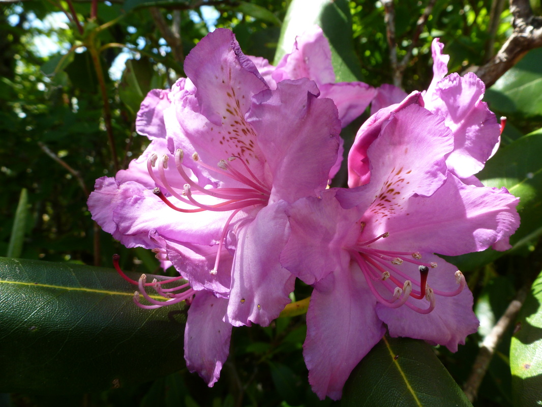
Catawba Rhododendron along Firescald Ridge
Along the AT

View from Firescald Ridge

View from Firescald Ridge
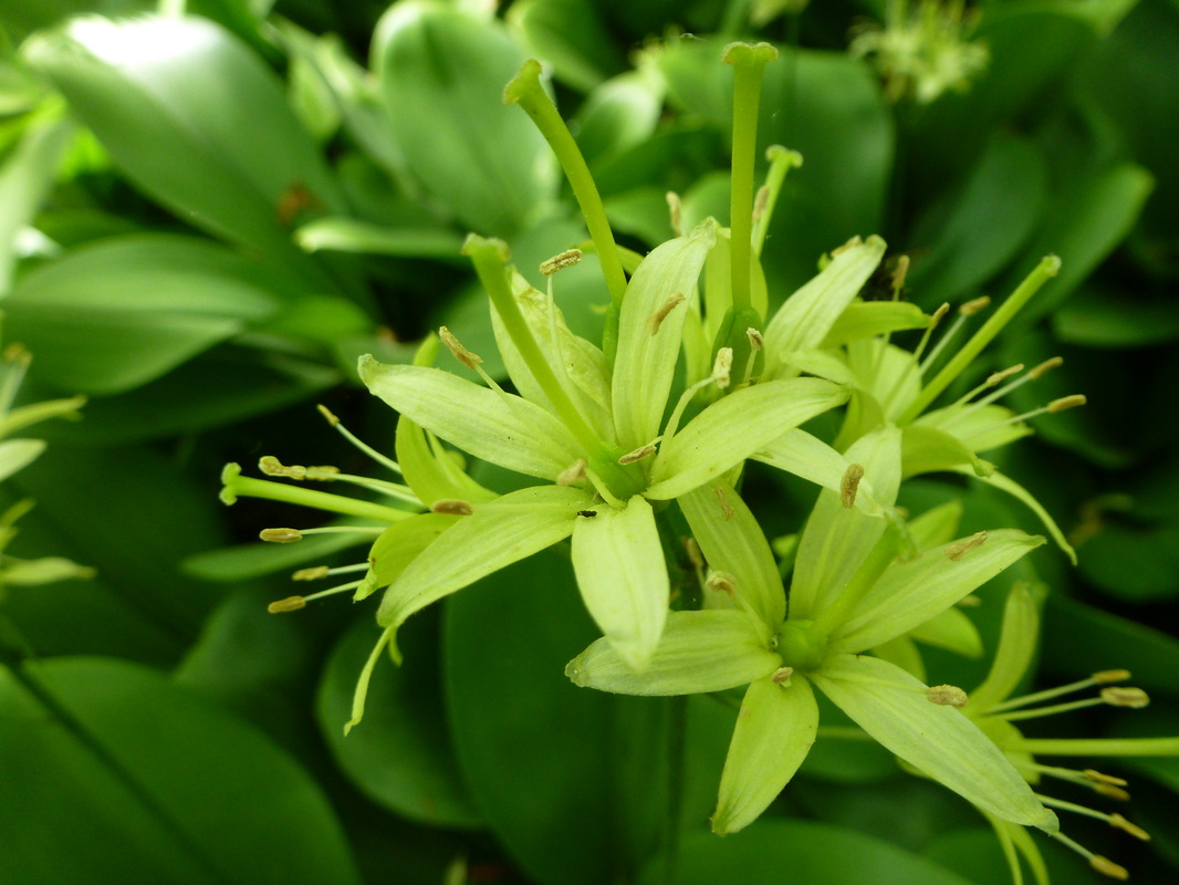
Bluebead Lily along Firescald Ridge
|
|
Driving Directions:
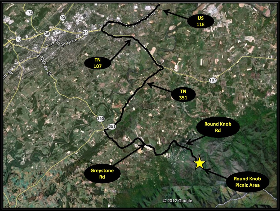
From ETSU, turn left onto State of Franklin Road. From State of Franklin Rd turn left onto US-11E headed toward Jonesborough and Greeneville. Stay on US-11E for approximately 23 miles and then turn left onto TN-107 in the direction of Erwin.
From TN-107, turn right onto TN-351. After about 4 miles turn left at the four-way stop onto Greystone Road. Continue on Greystone Road for about another 4 miles before making a right onto Round Knob Road. Follow Round Knob Road for 5 miles until reaching Round Knob Picnic Area and the start point for this hike. Round Knob Road turns into an unpaved road a couple of miles up from Greystone Rd. The road is well-maintained but also narrow, winding and popular. Driving Directions to Round Knob picnic Area using Google maps is linked here. |
